MARINE MAGNETIC
Marine Horizontal Transverse Gradiometer MariMag HTG
- High sensitivity and accuracy
- Built-in compass, accelerometer, leak detector, pressure and humidity sensors
- Optional altimeter
- Data collection on a recorder or PC
- Floating or sinking cable
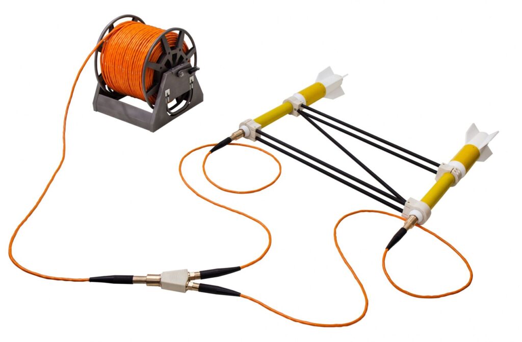
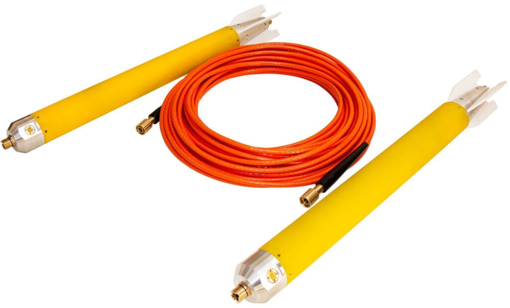
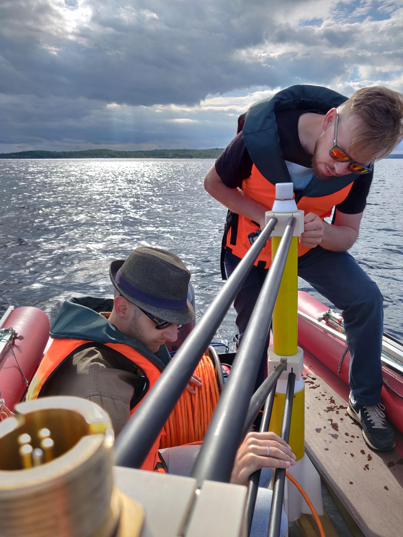
MariMag LG is a modern marine longitudinal gradiometer operating on Overhauser effect designed to perform geophysical, geotechnical and exploration works both in shallow and deep water. The device allows to measure the magnetic field gradient with high accuracy using two independent sensors. Each gradiometer gondola can be used as a separate towed magnetometer. Gradiometer consists of two magnetometer-gondolas and an inter-gondola cable of any length. Long inter-gondola sections (greater than 100 m) are suitable for regional and geological research, medium ones (from 10 to 100 m) – for solution of engineering problems and searching for large artificial objects. Sections less than 10 m are commonly used for seabed surveys, UXO detection, archaeological surveys and pipeline tracing.
A built-in pressure sensor, digital compass and accelerometer allow real-time gondola position calculation, while an optional altimeter provides towing depth in term of distance above seabed. Three versions of gondola ensure safe towing of the device at depths up to 300, 1000 or 3000 m.
MariMag
Overhauser sensors used in MariMag LG do not require orientation during operation and are maintenance free for 10 years. The modular principle of MariMag makes it easy to assemble towed magnetometer-gradientometers of various configurations with an almost unlimited number of sensors.
Work without base station
Working with transverse or longitudinal gradiometers allows to take into account variations in the magnetic field in real time, in contrast to standard hydromagnetic survey with base station, where variation is taken into account only during post-processing of data from the field magnetometer and magnetic base station.

Management and Data Acquisition Software
The software sets the device configuration and measurement parameters, displays the values of the modulus or magnetic field gradient, controls the operation of the device during the survey and visualizes its spatial position in real time. The module of survey design creates a network of observations with the option to download profiles in KML format or manually, plan the ship’s route to a given profile and navigate along it, place marks and control points comments, as well as download and visualize maps in KML format, as a raster Google images or satellite imagery.
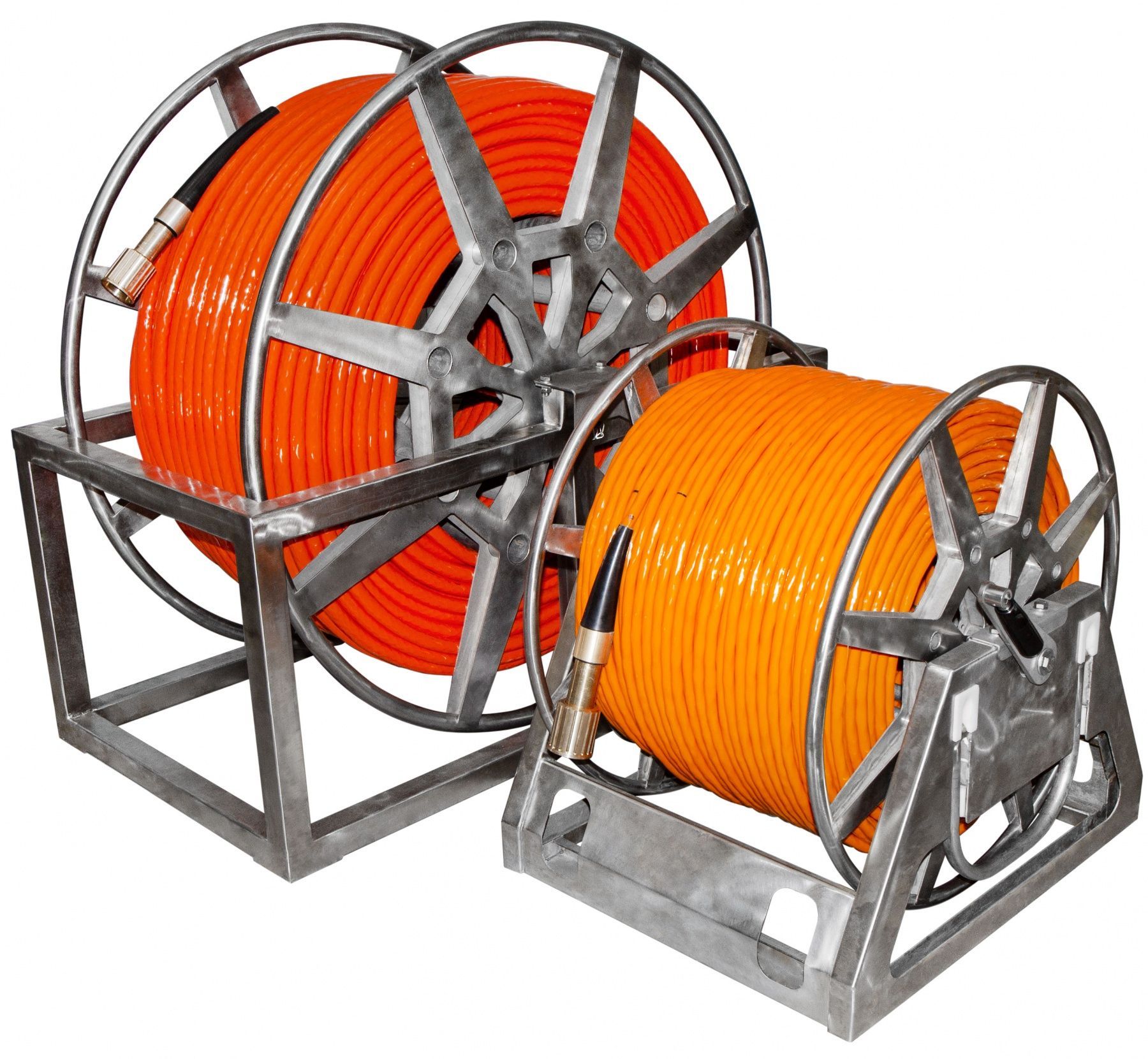
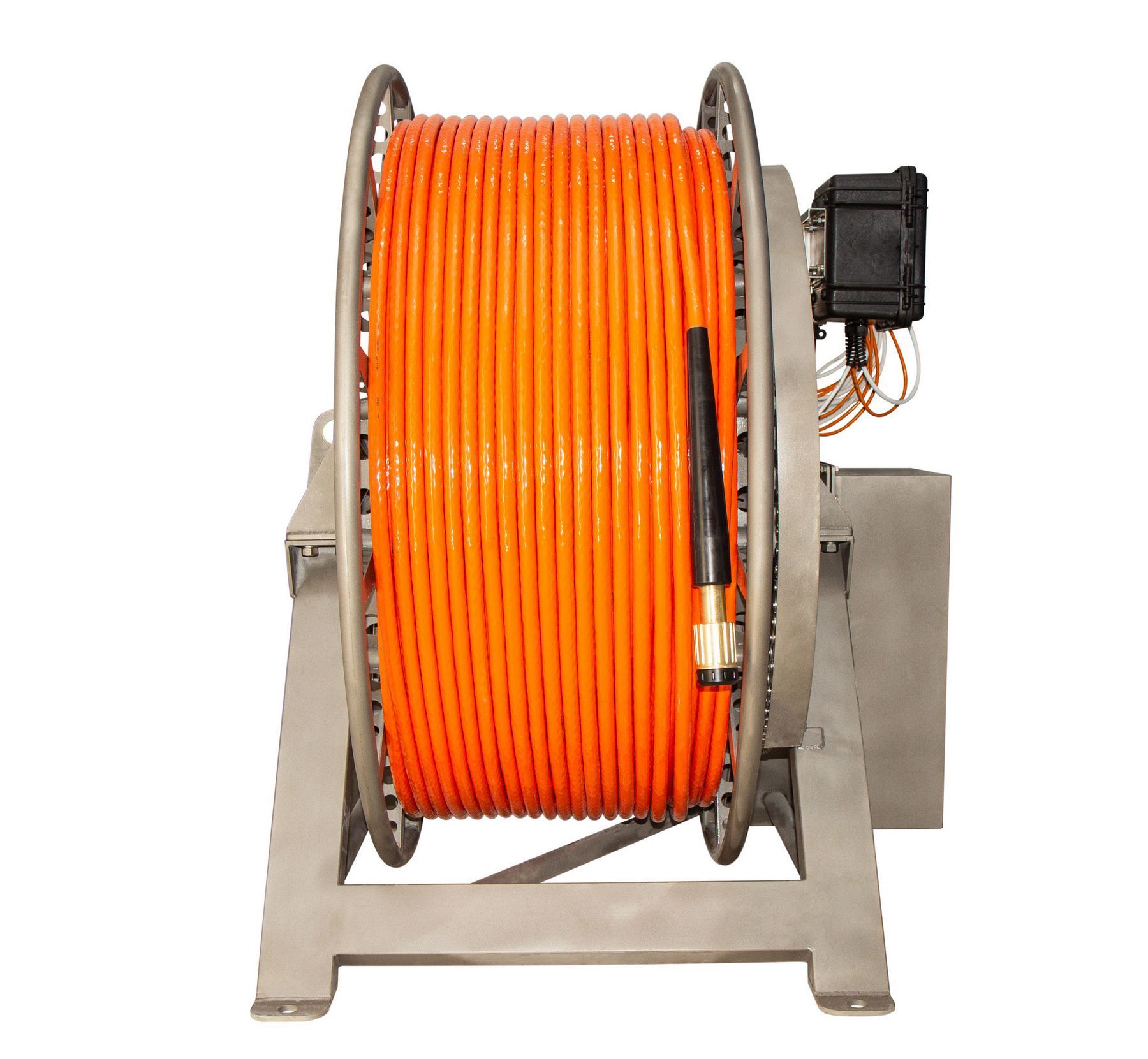
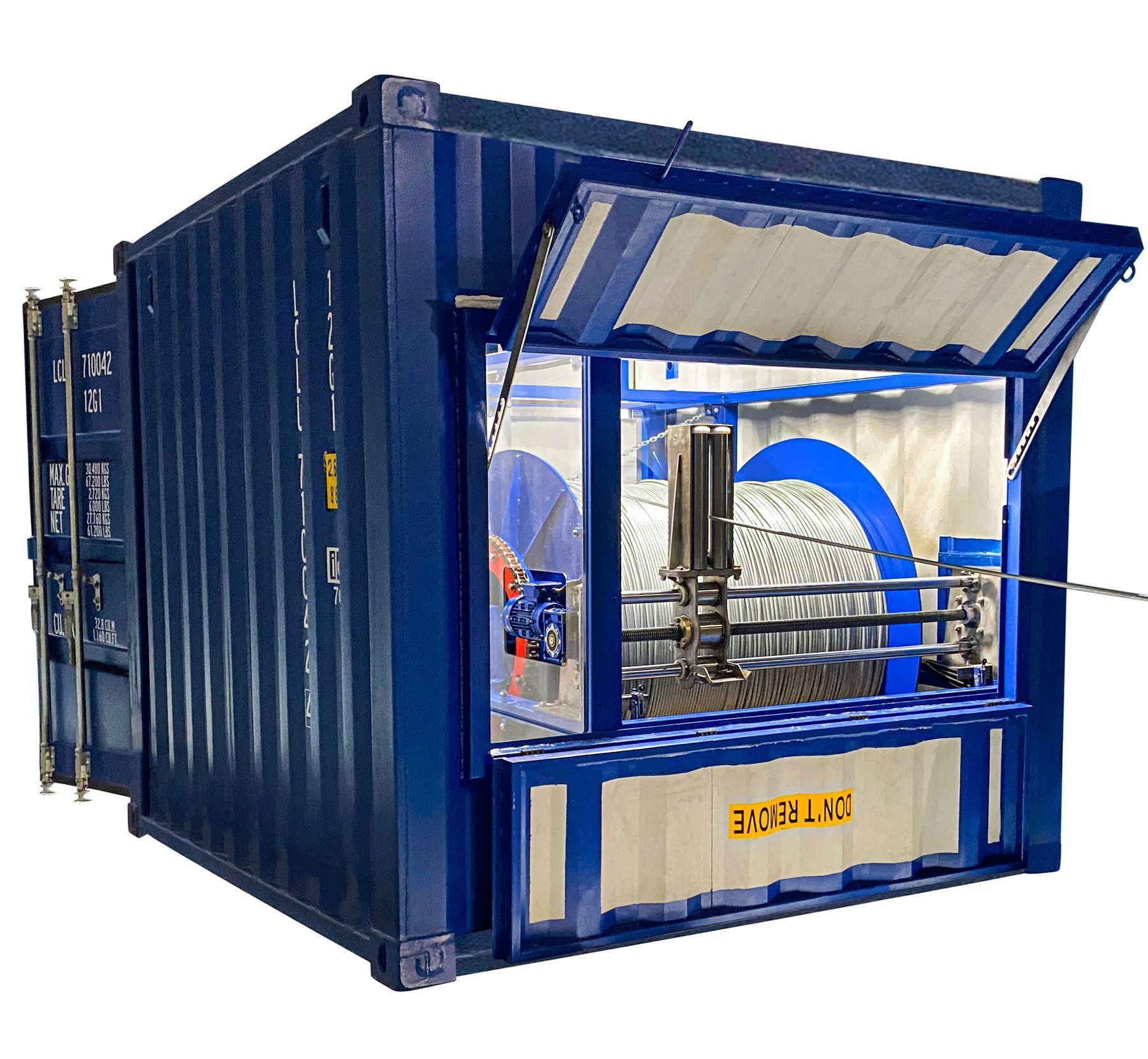
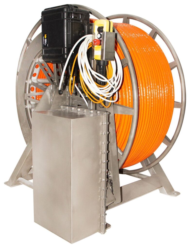
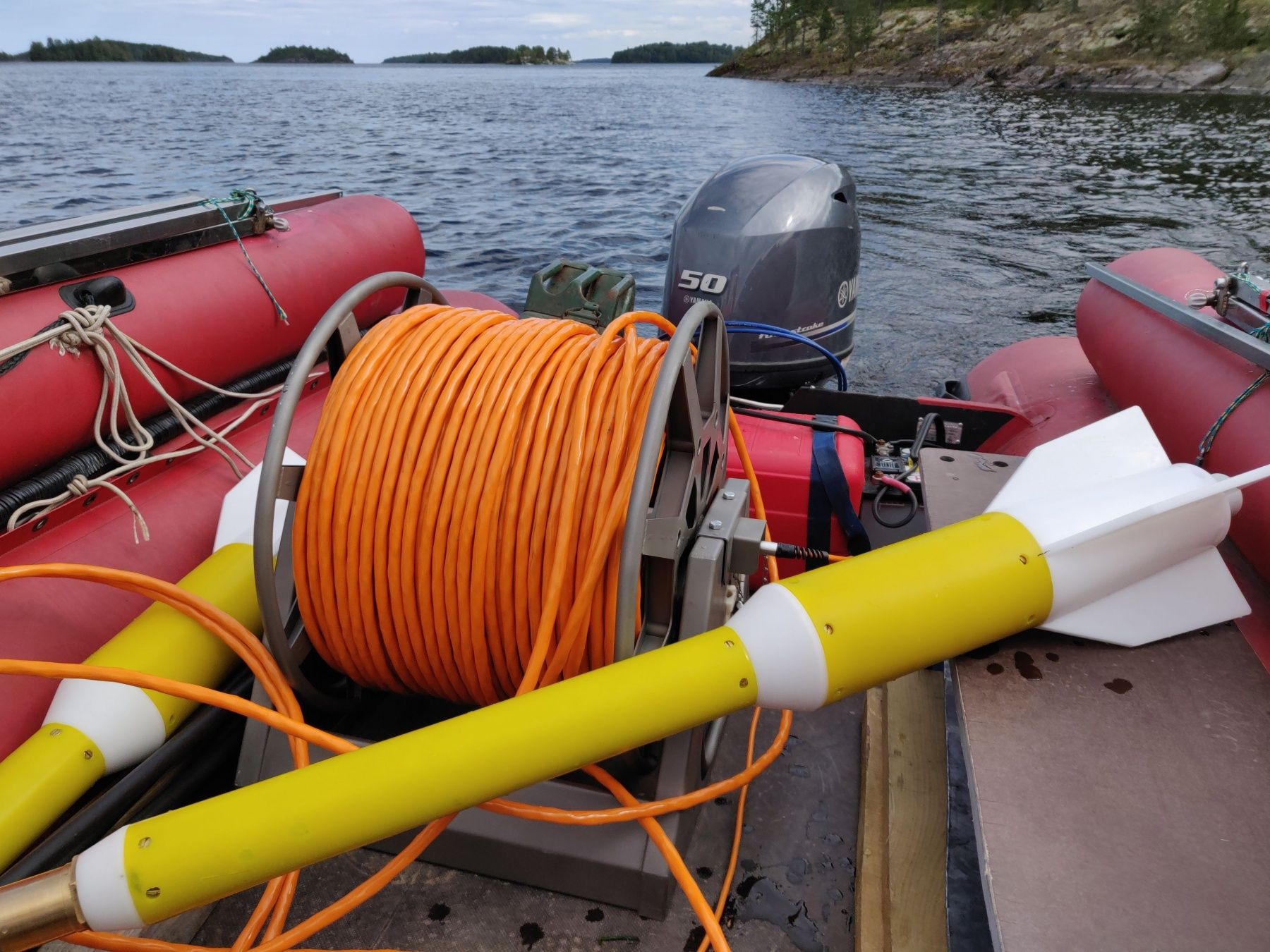
Cables, reels and winches
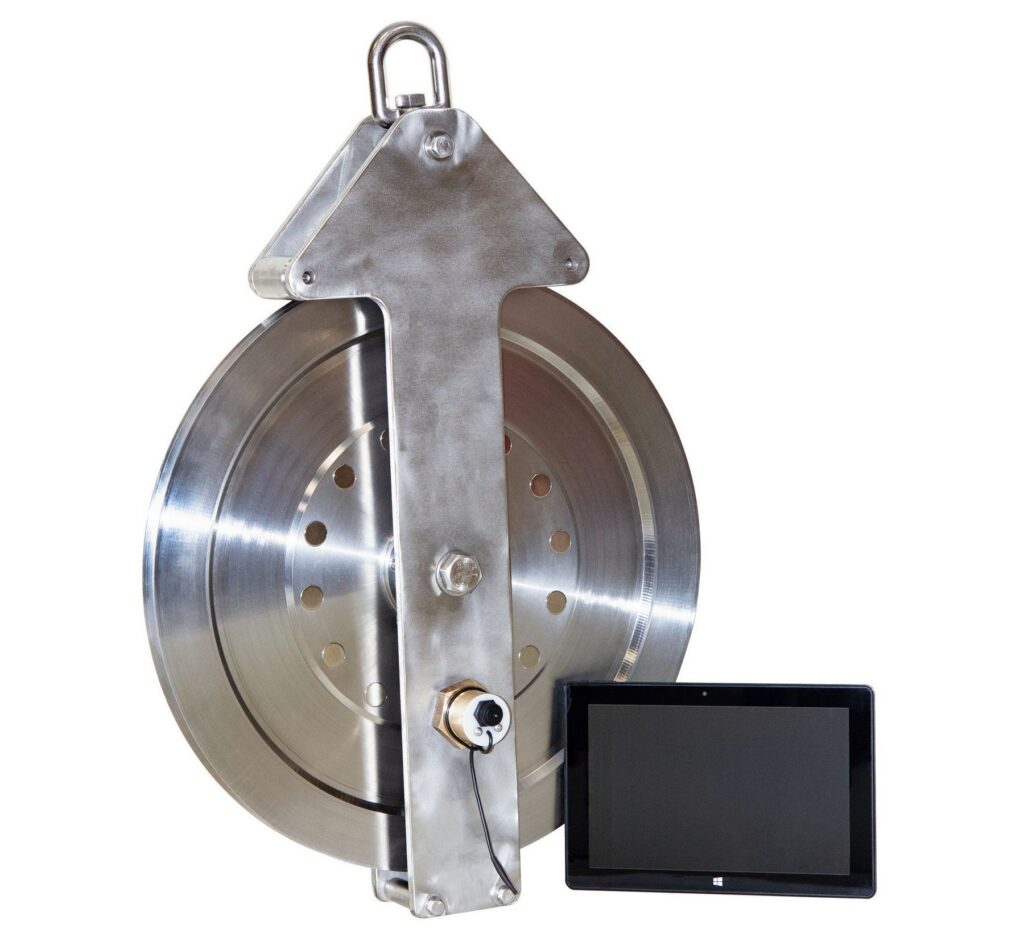
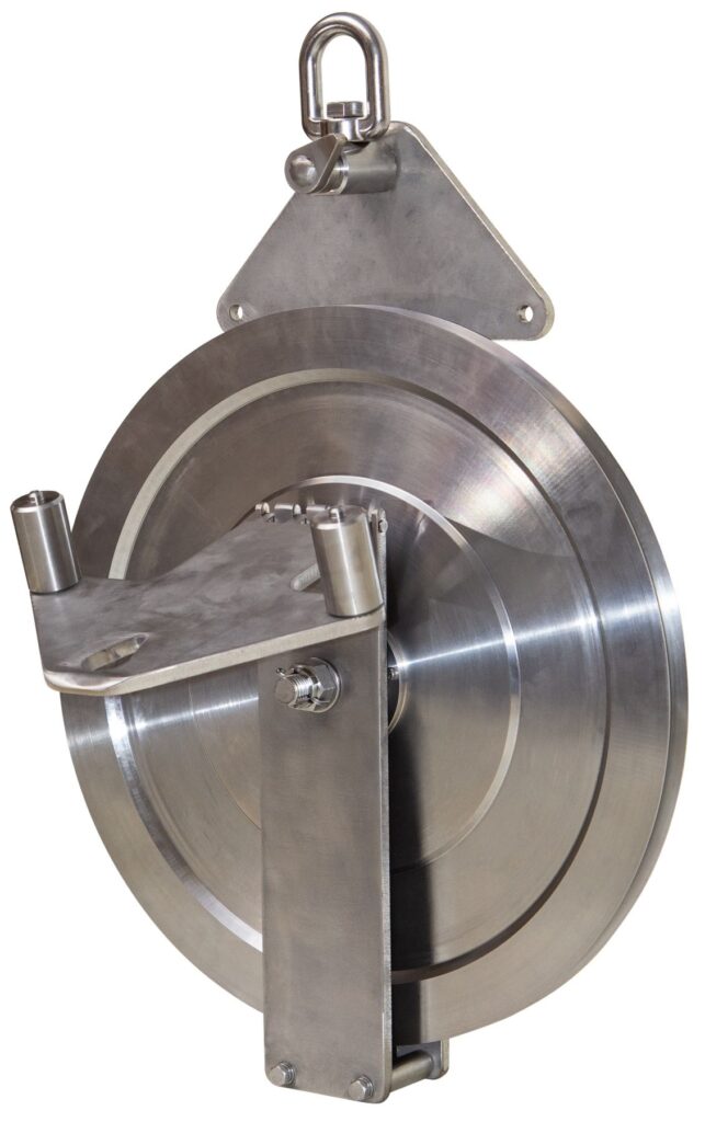
We have thought of different use scenarios and have developed a sinking cable for hydromagnetic surveys, a floating cable for near-surface hydromagnetic surveys, and a steel cable for towed magnetometers or gradiometers. For the convenience of the device use, we offer reels with a slip-ring, winches with slip-ring and electric drive, high-speed deck winches with slip-ring, electric drive, cable layer and a cable counter.
Areas of use:
- UXO detection
- Pipelines and cables detection and inspection
- Archaeological research
- Ecological research
- Engineering surveys
- Mineral exploration
- Exploration for oil and gas
- Regional exploration
MariMag LG gradiomenter includes
- MariMag magnetometer – 2 pcs
- Weight – 2 pcs
- Inter-gondola cable – 1 pc
- Recorder with built-in GNSS – 1pc
- Power supply with charger – 1 pc
- Power cable – 1 pc
- 100 ÷ 240 VAC power supply – 1 pc
- Ethernet сable – 1 pc
- Deck cable (70m) – 1 pc
- Data acquisition, visualization & control software – 1 pc
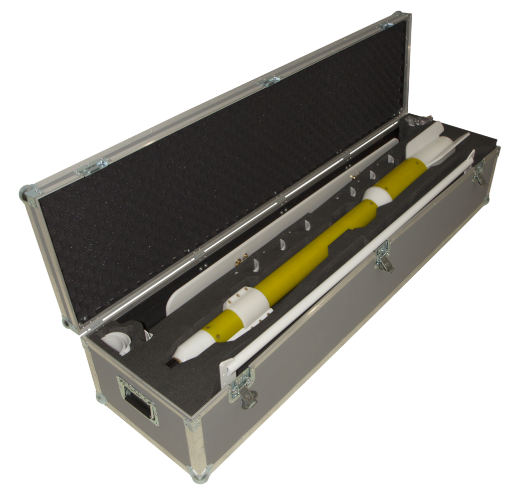
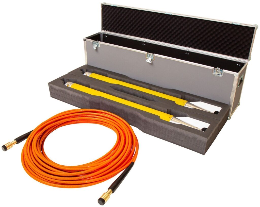
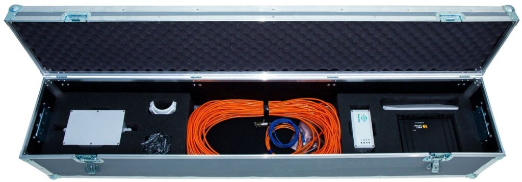
- Shipping/storage case – 1 pc
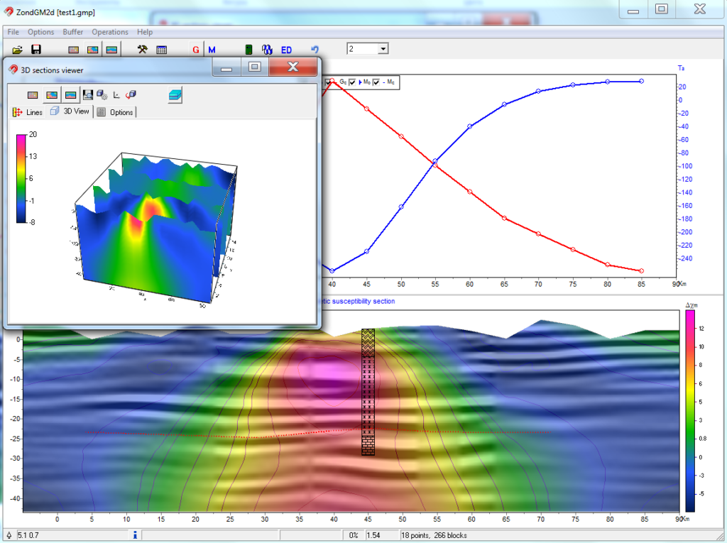
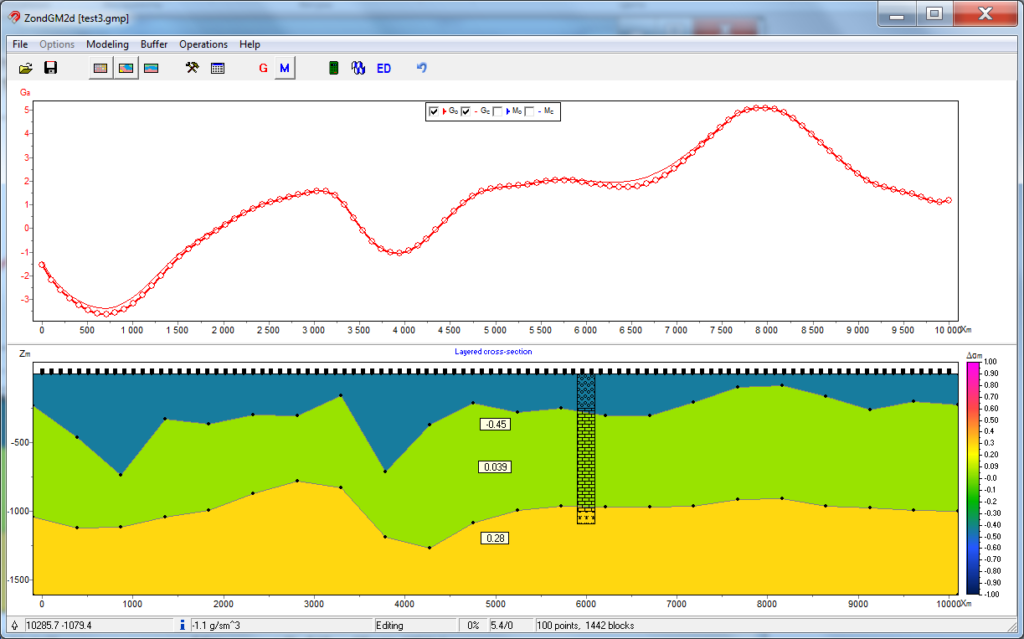
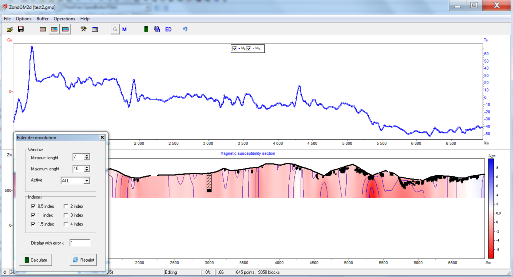
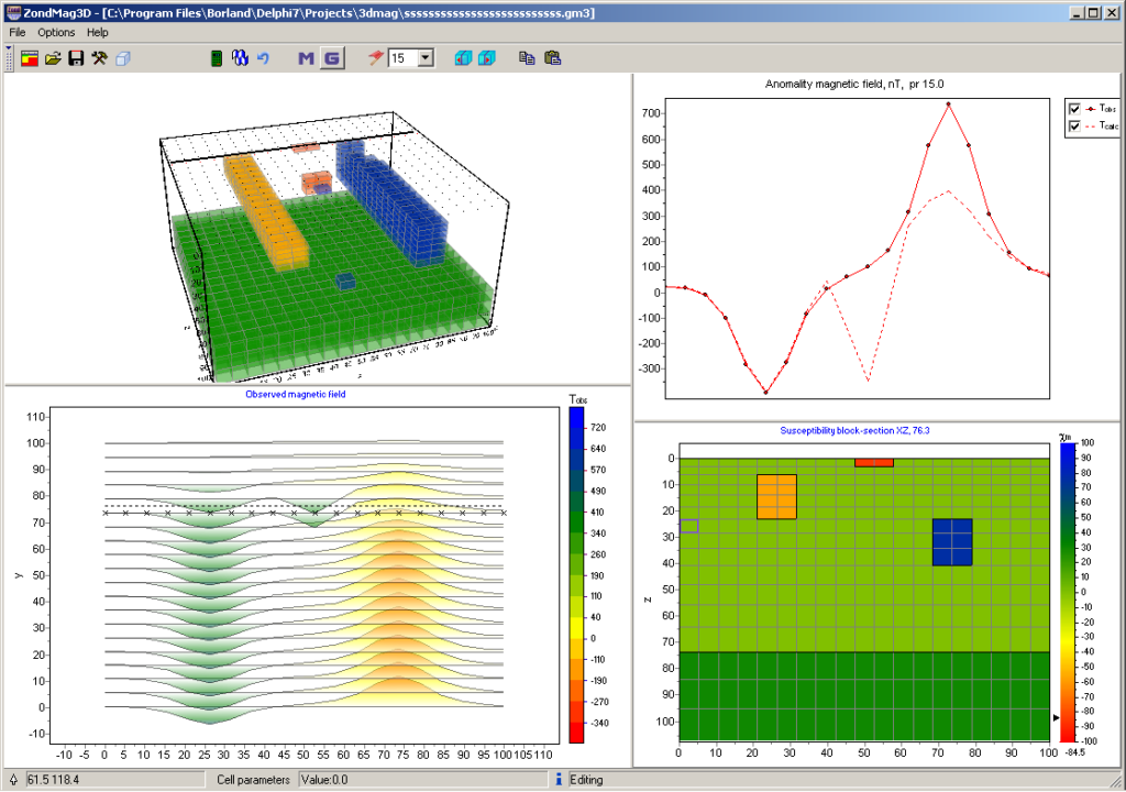
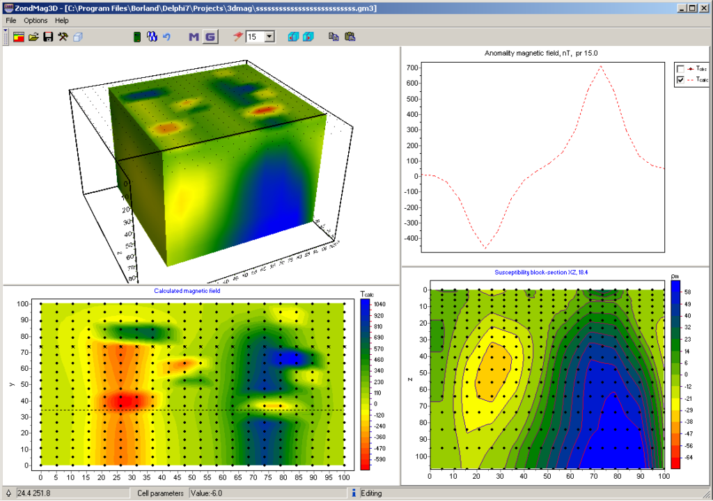
We manufacture magnetometers and gradiometers in various configurations. For the correct technical specification for purchase or rental of equipment, contact us in any way indicated on the site. We can also help you with the processing and interpretation of the data, or you can do it yourself in ZondGM2d and ZondGM3d software.
| Magnetic susceptibility measuring range | -1 ÷ 1 SI units |
| Sensitivity | 1×10⁻⁷ SI units |
| Memory | up to 32 GB (SD card) |
| Power supply | 3 x AAA batteries |
| Navigation | built-in GLONASS / GPS module |
| Connection to PC interface | USB 2.0, Bluetooth 2.1 EDR |
| Operating temperatures | – 20 ÷ +60°С |
| Protection | IP65 |
| Overall dimensions | 144×74×32 mm |
| Weight | 0.225 kg |
Marine Longitudinal Gradiometer MariMag LG

- High sensitivity and accuracy
- Built-in compass, accelerometer, leak detector, pressure and humidity sensors
- Optional altimeter
- Data collection on a recorder or PC
- Floating or sinking cable
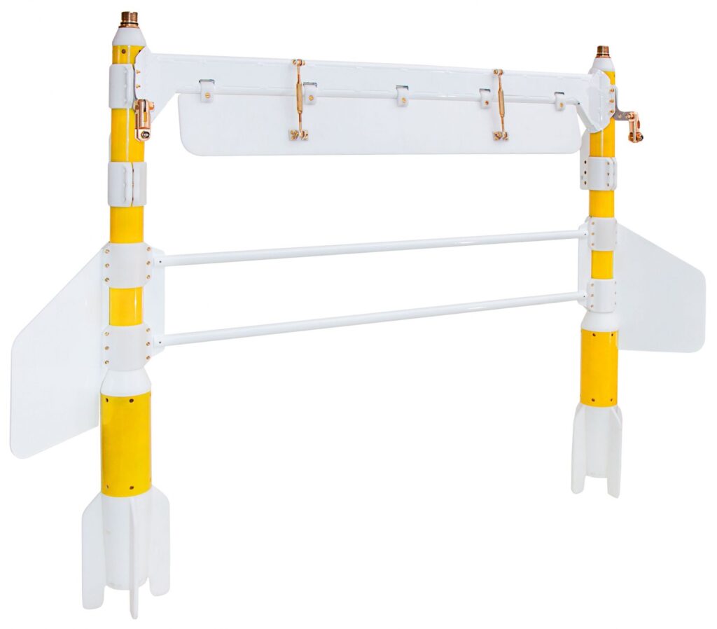
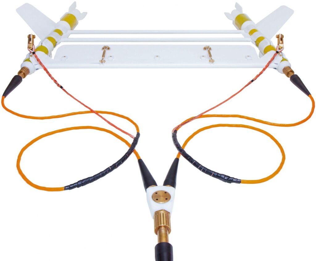
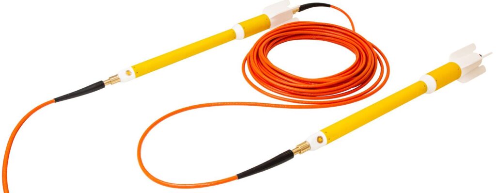
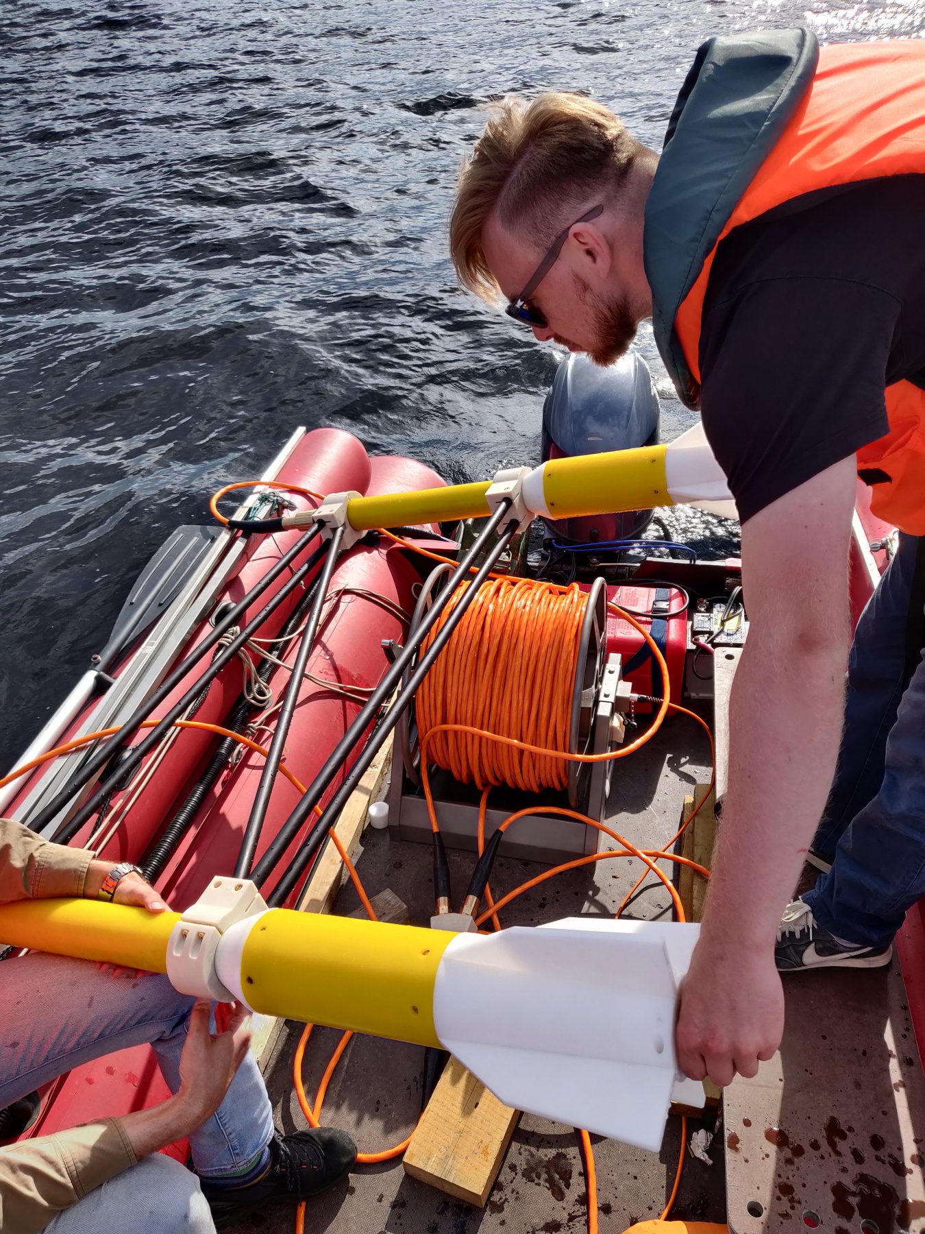
MariMag HTG is a modern marine horizontal transverse gradiometer operating on Overhauser effect designed to perform geophysical, geotechnical and exploration works both in shallow and deep water. The device allows to measure the magnetic field gradient with high accuracy using two independent sensors. Each gradiometer gondola can be used as a separate towed magnetometer.
The gradiometer consists of two magnetometer-gondolas, a Y-cable and an aluminum frame with a rear wing and transverse stabilizers. The modular yet rugged design allows ease of carrying the gradiometer and has low drag in the water. The front wing easily adjusts the depth of the gradiometer to the required one even with short lengths of tow cables. A built-in pressure sensor, digital compass and accelerometer allow real-time gondola position calculation, while an optional altimeter provides towing depth in term of distance above seabed.
MariMag
Overhauser sensors used in MariMag HTG do not require orientation during operation and are maintenance free for 10 years. The modular principle of MariMag makes it easy to assemble towed magnetometer-gradientometers of various configurations with an almost unlimited number of sensors.
Work without base station
Working with transverse or longitudinal gradiometers allows to take into account variations in the magnetic field in real time, in contrast to standard hydromagnetic survey with base station, where variation is taken into account only during post-processing of data from the field magnetometer and magnetic base station.

Management and Data Acquisition Software
The software sets the device configuration and measurement parameters, displays the values of the modulus or magnetic field gradient, controls the operation of the device during the survey and visualizes its spatial position in real time. Also, it chooses which GNSS should be used – internal or external.
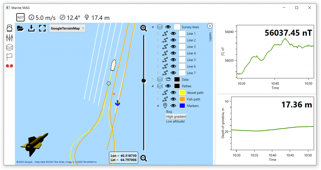
The module of survey design creates a network of observations with the option to download profiles in KML format or manually, plan the ship’s route to a given profile and navigate along it, place marks and control points comments, as well as download and visualize maps in KML format, as a raster Google images or satellite imagery.Cables, reels and winches
We have thought of different use scenarios and have developed a sinking cable for hydromagnetic surveys, a floating cable for near-surface hydromagnetic surveys, and a steel cable for towed magnetometers or gradiometers. For the convenience of the device use, we offer reels with a slip-ring, winches with slip-ring and electric drive, high-speed deck winches with slip-ring, electric drive, cable layer and a cable counter.
Areas of use:
- UXO detection
- Pipelines and cables detection and inspection
- Archaeological research
- Ecological research
- Engineering surveys
MariMag HTG gradiomenter includes
- MariMag magnetometer – 2 pcs
- Weight – 2 pcs
- Transverse frame – 1 pc
- Y-cable – 1 pc
- Recorder with built-in GNSS – 1pc
- Power supply with charger – 1 pc
- Power cable – 1 pc
- 100 ÷ 240 VAC power supply – 1 pc
- Ethernet сable – 1 pc
- Deck cable (70m) – 1 pc
- Data acquisition, visualization & control software – 1 pc
- Shipping/storage case – 1 pc
| Magnetometer | |
| Dynamic range | 18 000 to 120 000 nT |
| Absolute accuracy | 0.1 nT |
| Sensor sensitivity | 0.01 nT |
| Counter sensitivity | 0.001 nT |
| Resolution | 0.001 nT |
| Heading Error | 0.1 nT (180°) |
| Gradient tolerance | 30 000 nT/m |
| Max sample rate | 5 Hz |
| Interfaces | Ethernet |
| Power supply | 12 ÷ 30 VDC or 100 ÷ 240 VAC |
| Weight in air | 11 kg |
| Operation limitations | |
| Operation temperatures | -20 ÷ +60°C |
| Storage temperatures | -40 ÷ +70°C |
| Elevation | 3 000 m |
| Depth | 300, 1 000 or 3 000 m |
| Tow cable | |
| Breaking strength | 2 500 kg |
| Outer diameter | 13 mm |
| Weight in air | 125 g/m |
| Weight in water | 46 g/m |
| Floating cable | |
| Breaking strength | 2 500 kg |
| Outer diameter | 20 mm |
| Weight in air | 250 g/m |
| Weight in water | -20 g/m |
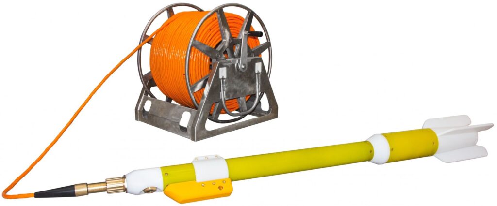
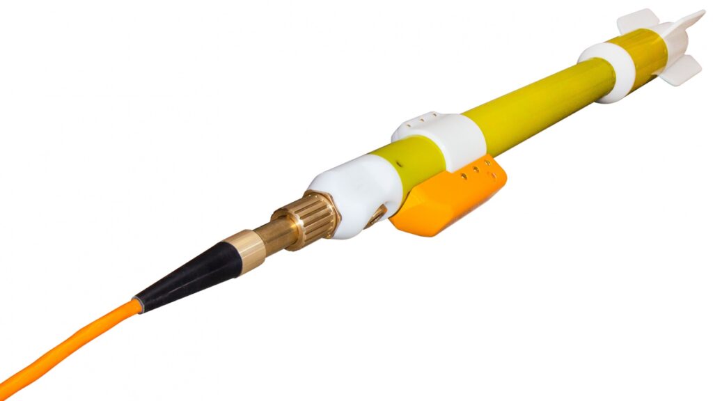
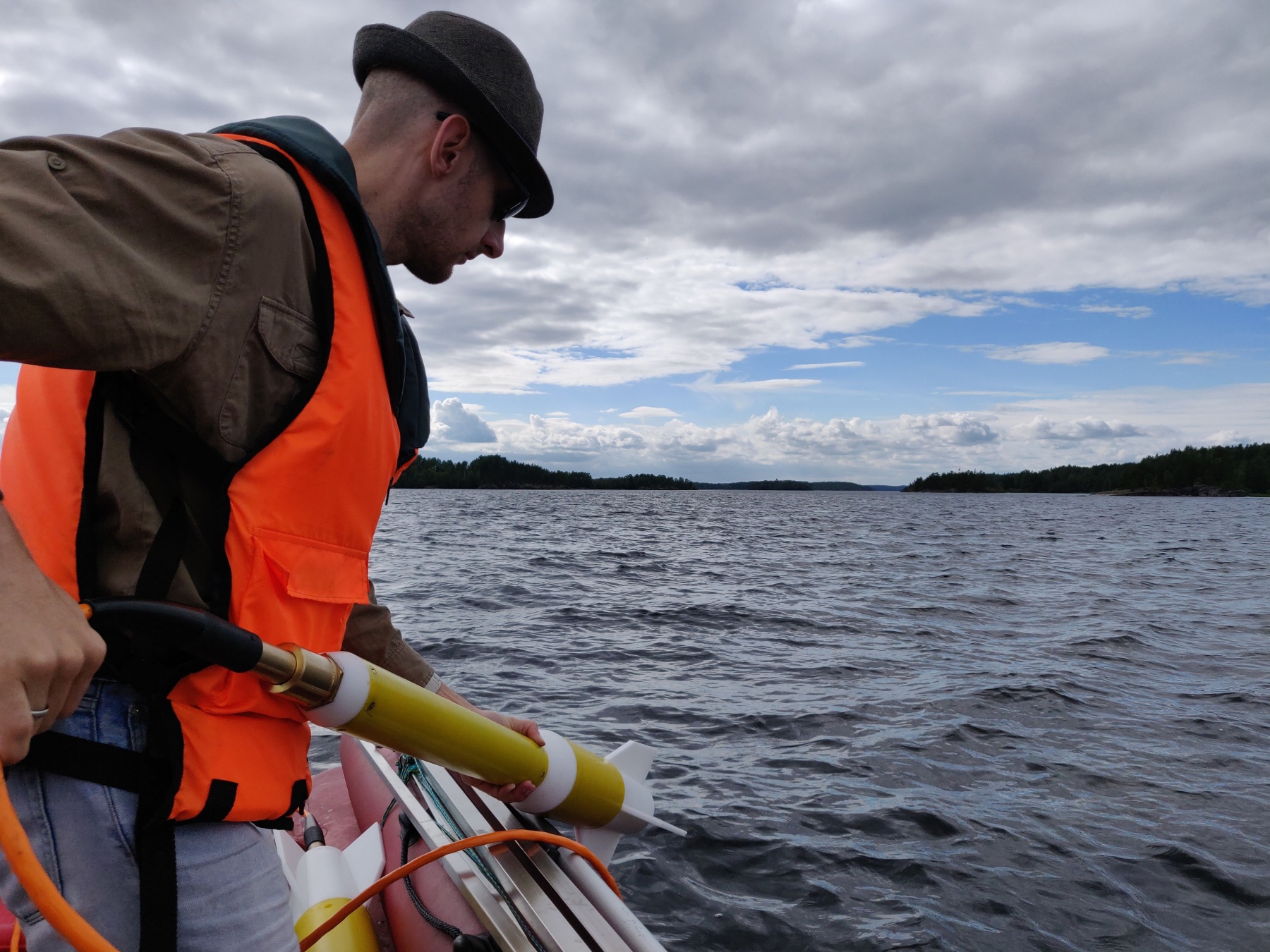
MariMag – Marine magnetometer
- Maintenance free Overhauser sensors
- High sensitivity and accuracy
- Built-in compass, accelerometer, leak detector, pressure and humidity sensors
- Lightweight and portable
MariMag is a highly sensitive and compact magnetometer designed for both shallow and deep-water applications. Equipped with precise, stable sensors, the system offers exceptional accuracy in detecting magnetic anomalies, making it ideal for a wide range of geophysical, environmental, archaeological, and defense-related surveys. Its modular design allows to easily deploy longitudinal and horizontal transverse gradiometers or single sensor magnetometer to suit specific survey needs. The system is complemented by intuitive software that facilitates equipment control, real-time data recording, and visualization, along with seamless data export for further analysis. MariMag’s adaptability, precision, and ease of use make it an invaluable tool for marine exploration, environmental monitoring, and underwater investigations.
MariMag magnetometer
- Maintenance free Overhauser sensors
- High sensitivity and accuracy
- Built-in compass, accelerometer, leak detector, pressure and humidity sensors
- Robust design
- Lightweight and portable
Isolation transceiver
- Built-in monochrome LCD display for the indication of all system parameters
- Safely shuts down in emergency cases
- Measurement control via built-in keypad
- Data storage to the built-in memory card
Tow cable
- High strength Kevlar strain member
- Floating version by request
- Maximum cable length with the standard power supply is 1000 m
MS Windows-based software
- MariMag monitoring and control
- Data visualization
- Ship and towfish positions plotting on a digital map
- Creation and editing of survey lines
Data acquisition, visualization & control software
MariMag system includes special software intended for the equipment management and control, as well as data recording and visualization, their upload in specified file formats. The software indicates the MariMag status in the real time, providing the information about signal strength, sample rate, synch, depth, altitude as well as leakage alarm. Convenient user-friendly interface and terminal access facilitate troubleshooting and resolve issues.
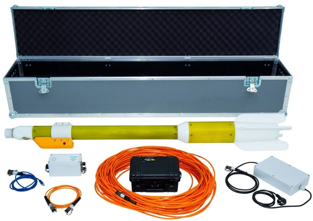
MariMag set includes
- MariMag magnetometer
- Tow cable
- Isolation transceiver
- Power supply
- Ethernet сable
- Data acquisition, visualization & control software
- Operation manual
- Spare parts kit
- Shipping/storage case
Optional components
- Altimeter
- Deck cable
- Deck winch for tow cable
| Magnetometer | |
| Dynamic range | 18 000 to 120 000 nT |
| Absolute accuracy | 0.1 nT |
| Sensor sensitivity | 0.01 nT |
| Counter sensitivity | 0.001 nT |
| Resolution | 0.001 nT |
| Heading Error | 0.1 nT (180°) |
| Gradient tolerance | 30 000 nT/m |
| Max sample rate | 5 Hz |
| Interfaces | Ethernet |
| Power supply | 12 ÷ 30 VDC or 100 ÷ 240 VAC |
| Weight in air | 11 kg |
| Operation limitations | |
| Operation temperatures | -20 ÷ +60°C |
| Storage temperatures | -40 ÷ +70°C |
| Elevation | 3 000 m |
| Depth | 300, 1 000 or 3 000 m |
| Tow cable | |
| Breaking strength | 2 500 kg |
| Outer diameter | 13 mm |
| Weight in air | 125 g/m |
| Weight in water | 46 g/m |
| Floating cable | |
| Breaking strength | 2 500 kg |
| Outer diameter | 20 mm |
| Weight in air | 250 g/m |
| Weight in water | -20 g/m |
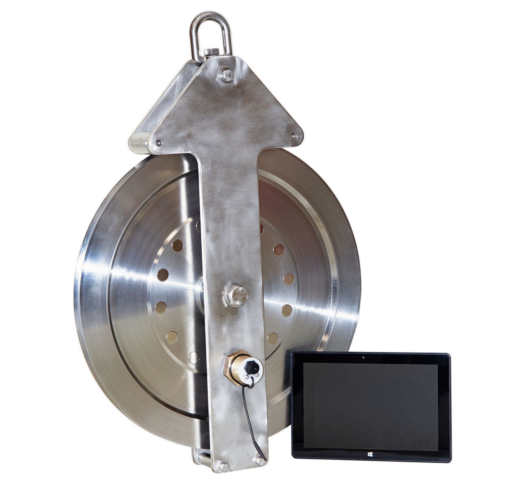
Cable Counter
Equipment & Software for Geophysical Surveys: Design, Manufacture, Support, Supply
GEODEVICE is a group of specialized companies that develops, manufactures, and supplies
advanced geophysical equipment and software for a wide range of applications, from land-
based surveys to marine and borehole explorations.
The key areas of GEODEVICE developments are high and ultra-high resolution marine seismic,
borehole seismic, land, drone and marine magnetic.
The focus is on a broad range of industries and scientific fields, providing tailored solutions for:
- Geotechnical Monitoring
- Engineering Surveys
- Environmental Surveys
- Archaeological Surveys
- Geophysical Support for Geological Exploration
Let’s Connect
Need assistance? Get in touch with our team.