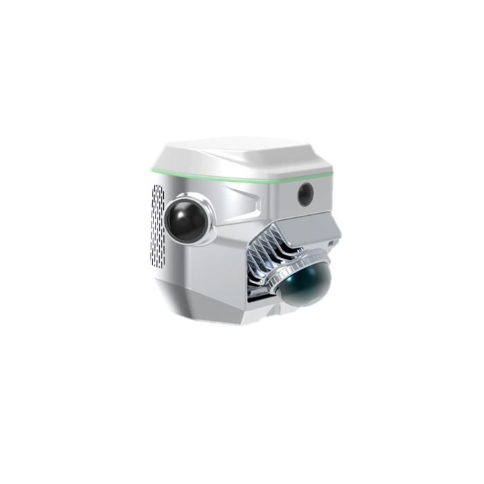
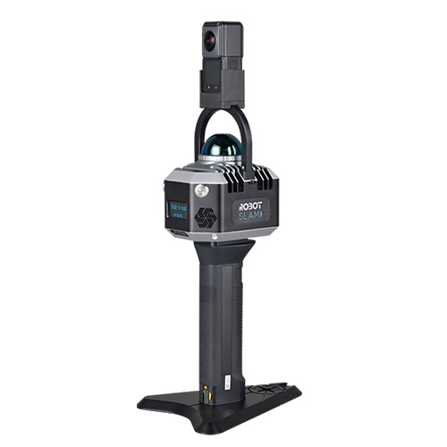
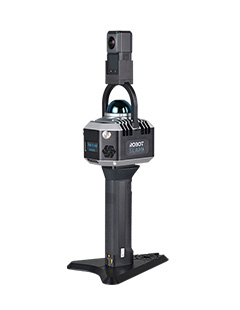
Lidar Scanner
ME
SLAM RTK
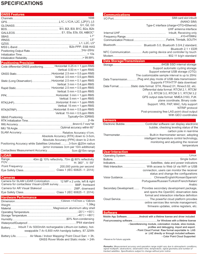
RobotSLAM Standard
Professional SLAM
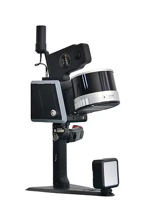
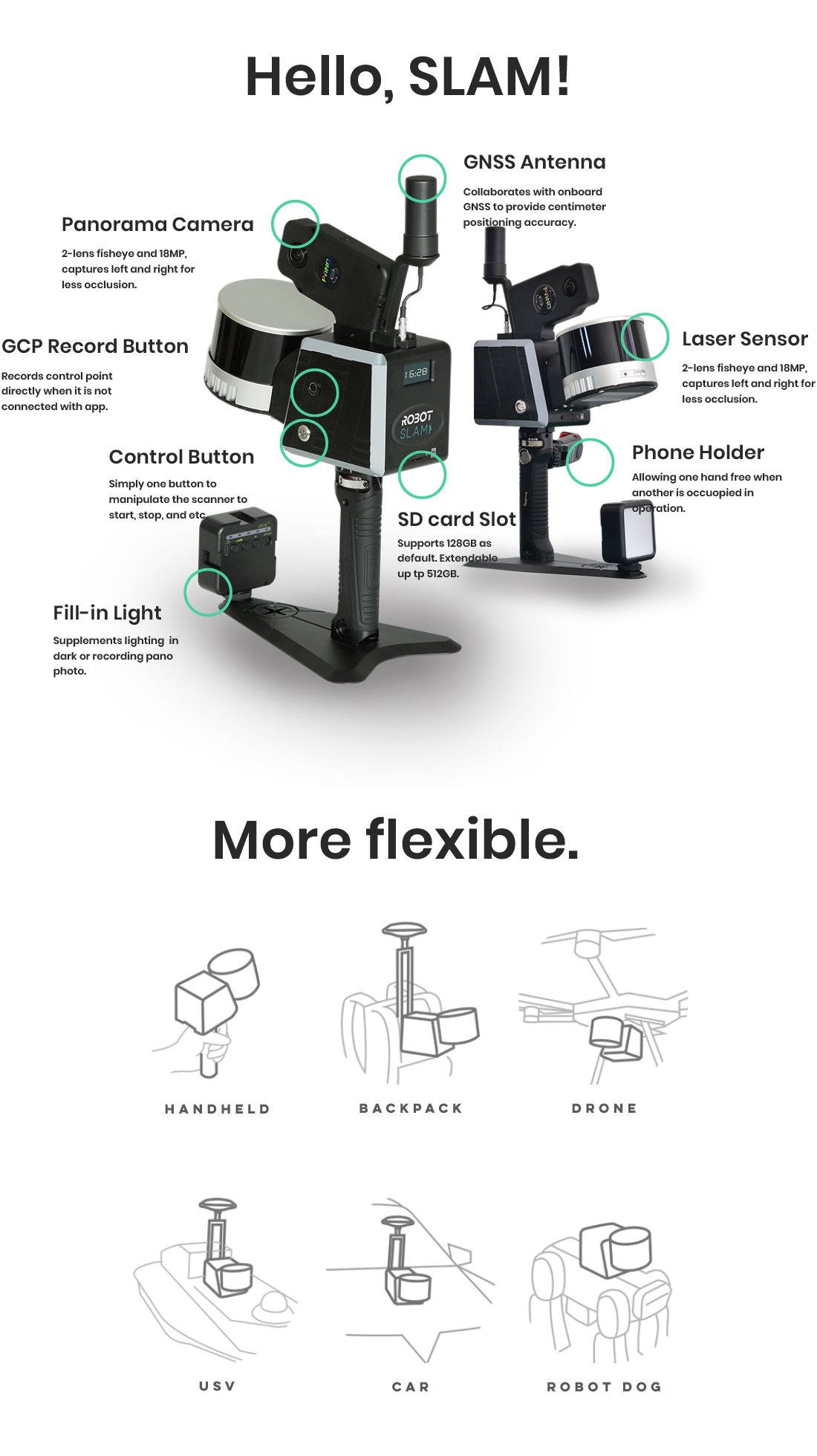
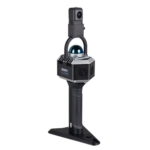
RobotSLAM Lite
Entry-level SLAM
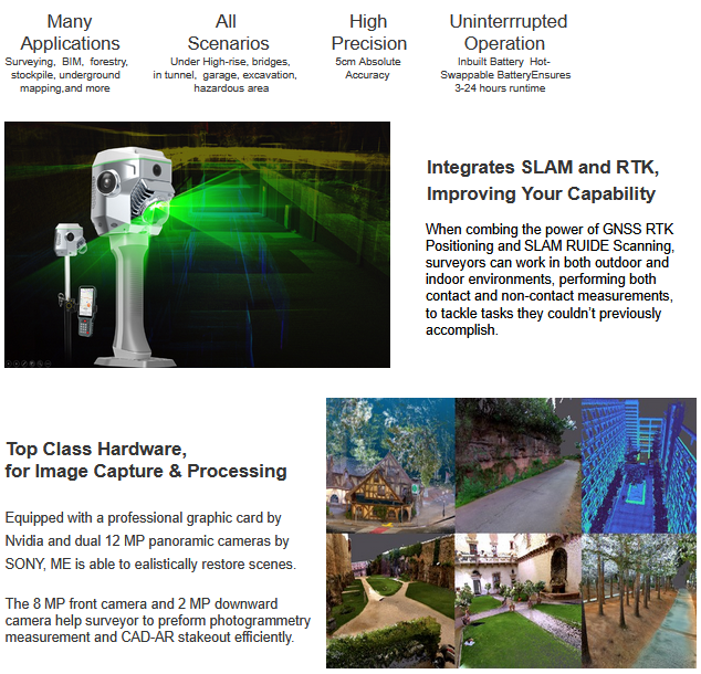
Accurate and Fast
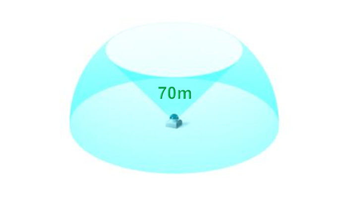
RobotSLAM Lite is able to collect 200,000points per second,with a scanning range of 70 meters
and achieve a relative point accuracy of 1cm (in the best condition).
The 6K resolution video captured by the 360° panoramic cameraprovides texture and color details
for the point cloud data, enabling the generation of 3D models with precise geometric shapes and
rich appearance textures.
This is conductive to accurate positioning,path planning,and a detailed understanding of the environment.
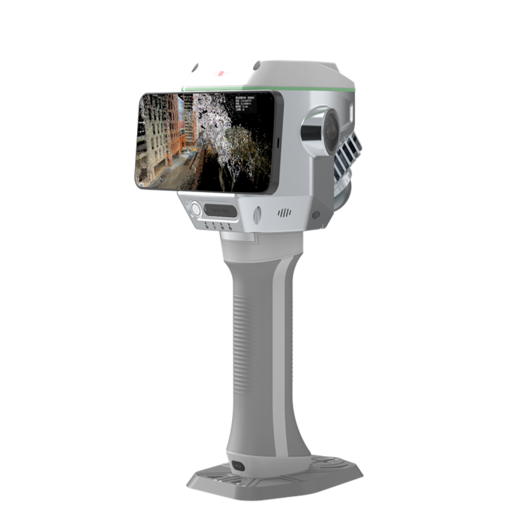
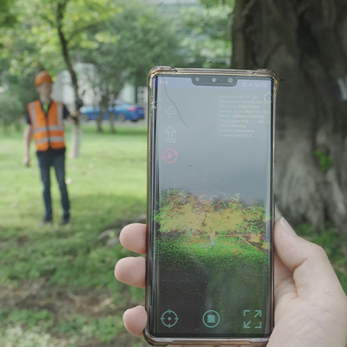
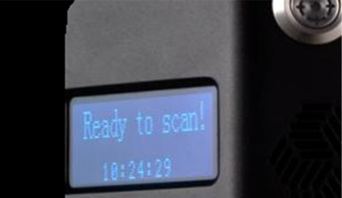
Real-time and Convenient Interaction
The LED screen displays the working status of the device in real time, allowing you to clearly know the operation of
the device and the progress of data collection at a glance, ensuring the smooth progress of the work.
The main control and GCP (ground control point) record buttons combine traditional and new operation
methods to meet your operating needs in different environments.
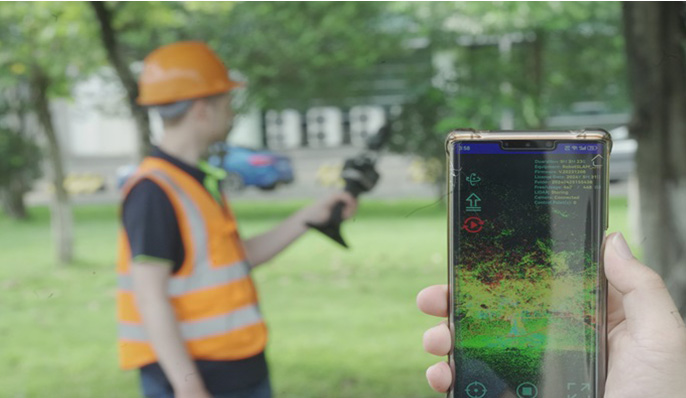
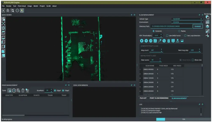
Visualized workflow
With the hardware support of LiDAR, visual sensors,This lets you intuitively grasp environmental conditions,
adjust work strategies promptly, and improve work efficiency.
This feature will make effective support for scenarios with high timeliness requirements such as emergency rescue.
Convenient and Vivid result Presentation
On RobotSLAM Engine (PC software), color point cloud data can be output by just one-click .
This simplifies data processing, vividly shows environmental features,improves data readability.
It helps accurately identify targets in the fields of architectural surveying and mapping, cultural relics protection, etc.
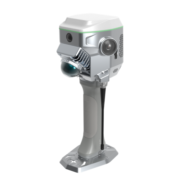
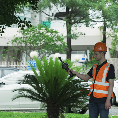
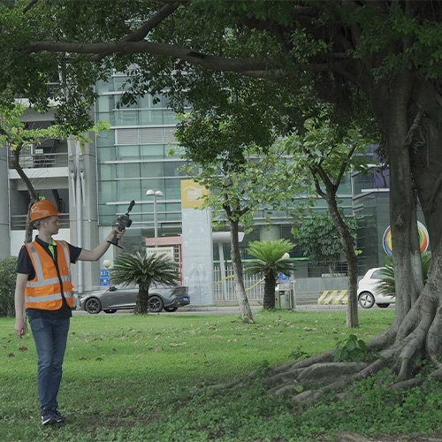
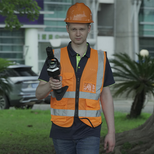
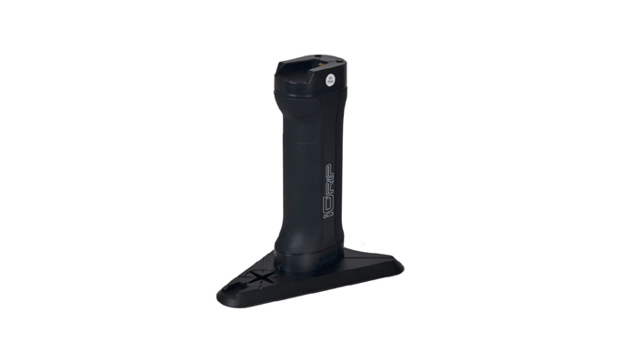
Lightweight,Powerful,Easy to Handle
RobotSLAM Lite weighs only 1.29KG, is easy to carry and handle.
The battery life of 2~2.5 hours meets the basic needs of most common task scenarios.
RobotSLAM Lite’s Magazine-style handle battery is designed with a lever-knob mechanism,
ensuring a tight fit between the handle and the device. It is not easy to come off and will not harm your hands.
High Protection level, Low Maintenance risk
The dustproof design of RobotSLAM Lite can effectly prevents dust from entering the device interior,
reduces the probability of malfunctions caused by dust and extends the service life of the device.
In dusty environments such as construction sites, mines, stockyard etc.
RobotSLAM Lite can maintain accuracy and stability.
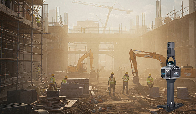
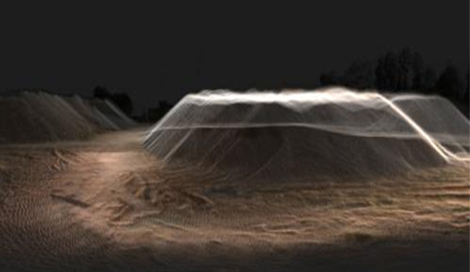
Application 1:
Stockpile Calculation
The point cloud data generated in real time can quickly and accurately calculate the volume and
weight of the stockpile, avoiding safety risks while improving measurement efficiency and accuracy.
Application 2:
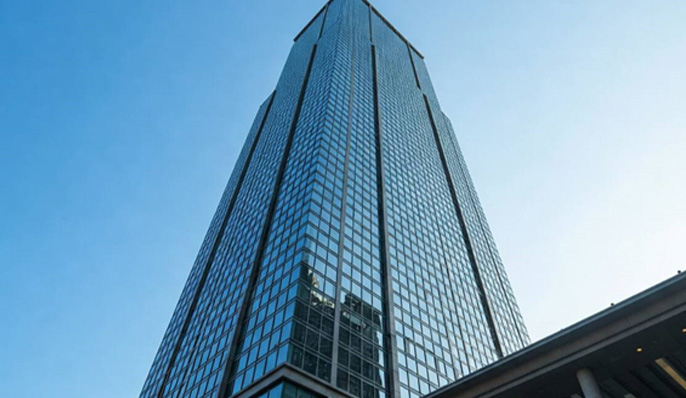
Architecture Facade
Capture the appearance of building facades from multiple anglesshowing the material, color,
texture and other details of the building’s exterior.
Application 3:
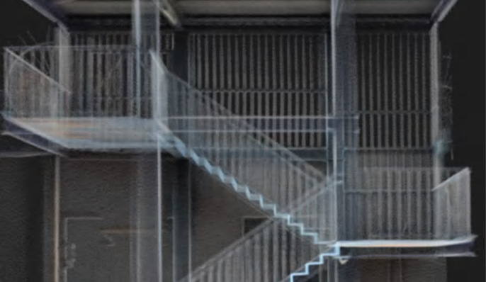
Building Interior
It can go deep into every corner of the building, clearly present the interior space structure,
and accurately outline architectural elements such as walls, doors, windows, and stairs.
Application 4:
Tunnel Engineering
Tunnel engineering is a complex and risky environment, and the product provides reliable safety assurance and precise
construction support.During work, construction workers can keep abreast of the real-time situation at any time.
Through the 360° panoramic camera, cracks, leakage and other hidden dangers in the tunnel wall can be
discovered in time, and measures can be taken in advance.
Moreover, detailed original data is provided for the later maintenance and management of the tunnel to
ensure the long-term safe operation of the tunnel.
Application 5:
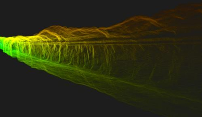
Landscape Reconstruction
In landscape reconstruction projects such as natural scenic spots and urban parks, lightweight equipment is easy to carry,
allowing people to go deep into mountain,forests, riverbanks and other areas to collect data on terrain, vegetation, etc.
The full view of the natural landscape recorded by the 360° panoramic camera is combined with color point cloud
technology to obtain original landscape information.

Application 6:
Emergency Response
At disaster sites such as earthquakes and fires, a three-dimensional map of the disaster site can be quickly drawn.
The information obtained can provide important basis for the rescue command center to formulate rescue plans,
helping rescue personnel to carry out rescue operations efficiently.
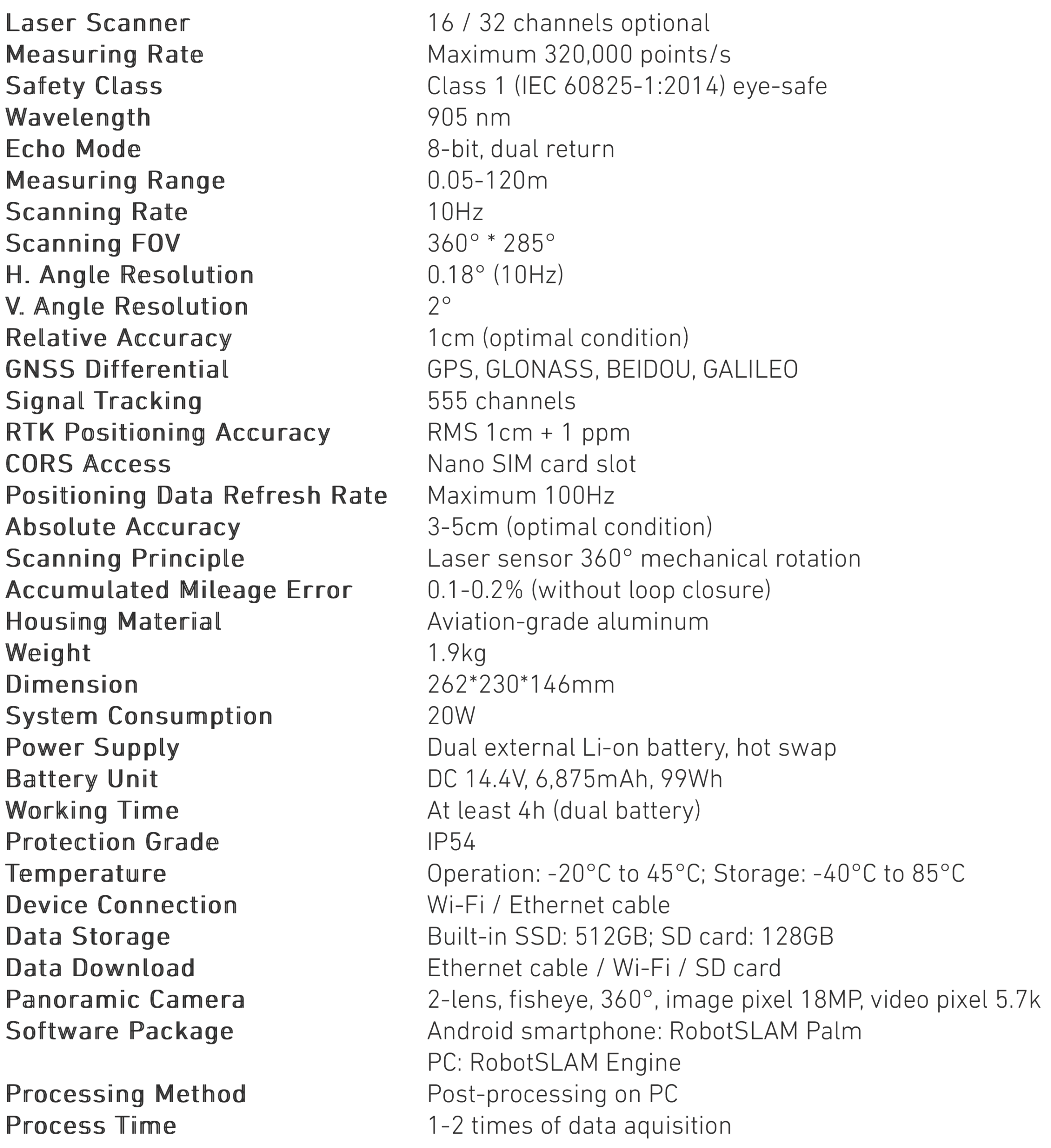
| Series | RobotSLAM | Dimension | 180x132x312 mm (w/o camera);180x132x386 mm (with camera) |
| Model | RobotSLAM Lite | ||
| Laser Wavelength | 905nm | Weigh | 1.29KG |
| Laser Safety Class | CLASS 1 (IEC 60825-1:2014), eye-safe | Power Supply | handheld grip with inbuilt battery, cable-free connection |
| FOV | horizontal 360°, vertical -7°~52° | Endurance | 2~2.5 hours |
| Measuring Range | 0.1~70 m (70 m @80% reflectivity; 40 m @10% reflectivity) | Input Voltage | DC 9~27 V |
| LED Screen | available | ||
| Measurement Rate | 200,000 pts/sec | Relative Accuracy | best up to 1 cm |
| Scanning Rate | 10 Hz | Realtime Point Cloud | available |
| IMU Module | built in, with push frequency 200 Hz(when enabled) | Realtime Trajectory | available |
| Anti-interference | available | Pano Camera | external, Pano360 II, 2-lens fisheye 360°, 21 MP in total |
| Temperature | -20℃~65℃ (operating),-40℃~70℃ (storage) | Software | RobotSLAM Palm (smartphone APP) |
| IP Protection | IP 67 | RobotSLAM Engine (PC) |
Let’s Connect
Need assistance? Get in touch with our team.