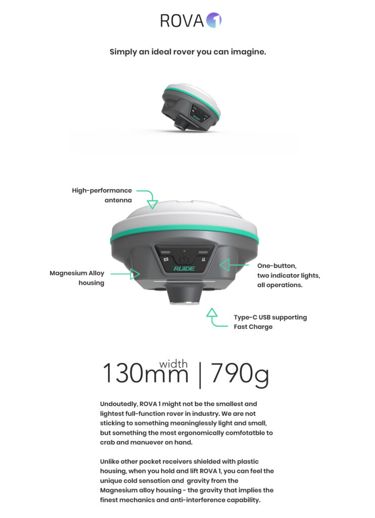
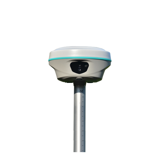
GNSS Receivers / RTK
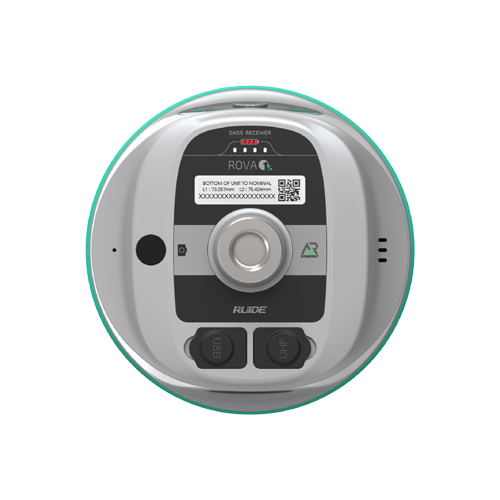
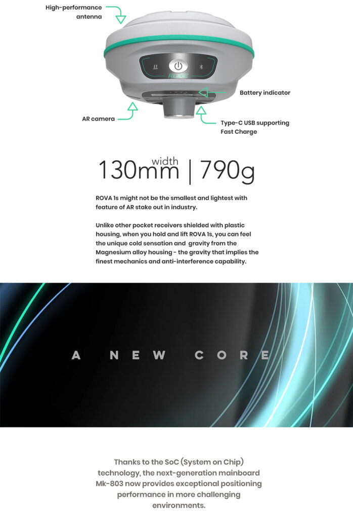
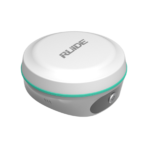
ROVA 1S
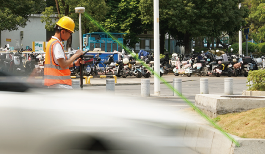
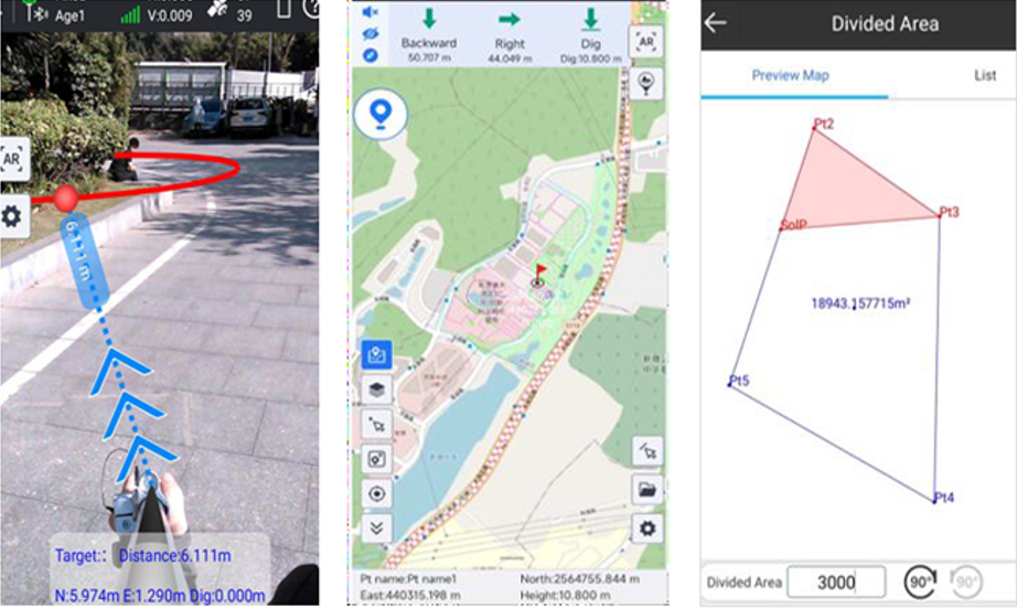
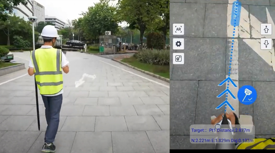
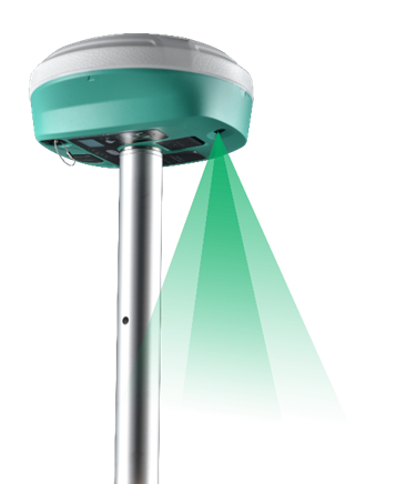
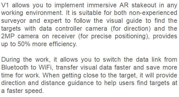
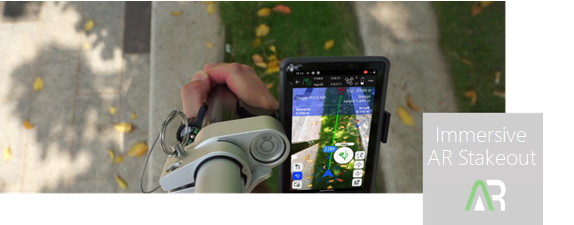
Live-view AR Stakeout by Camera Inbuilt
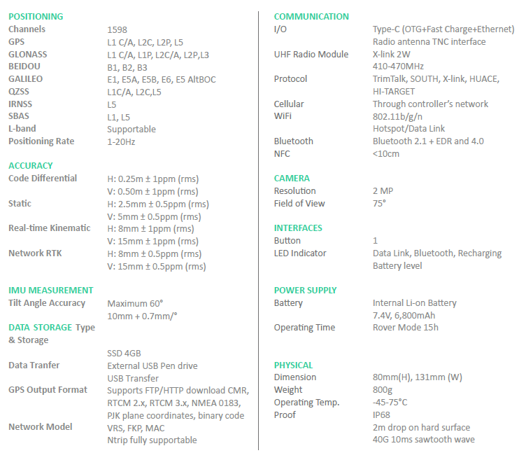
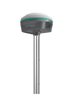
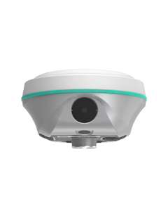
ROVA 1
The Most Portable Unit with IMU and 2W Radio
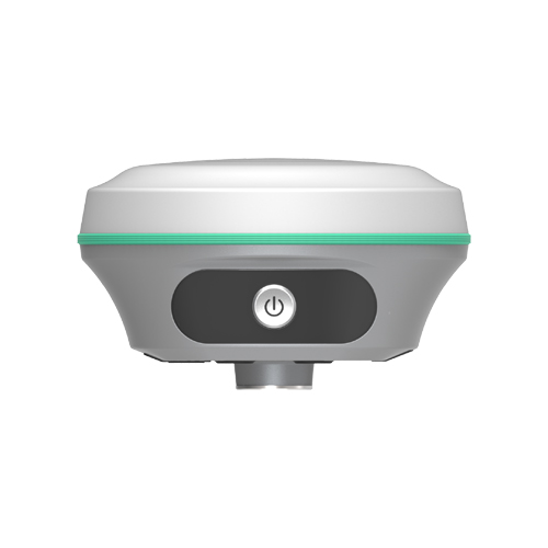
ROVA2
High Performance GNSS Receiver
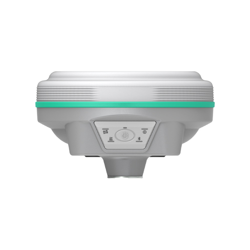
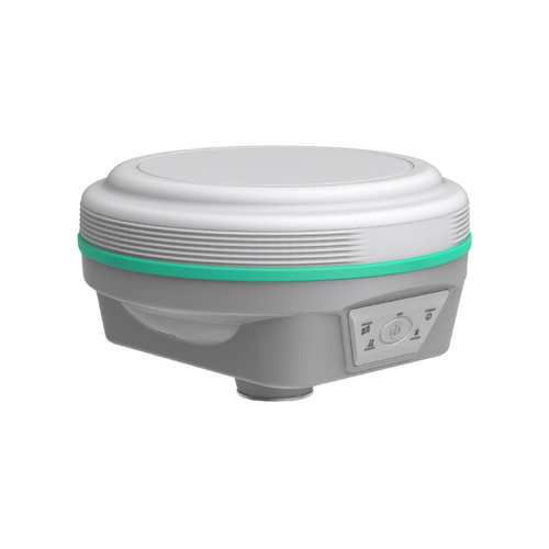
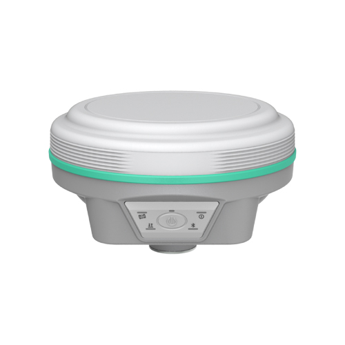
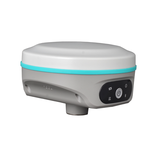
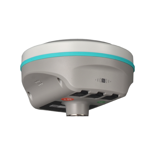
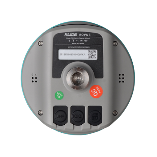
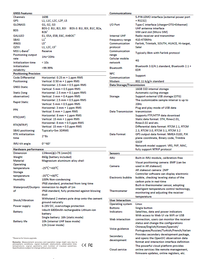
ROVA3
2025 New Model
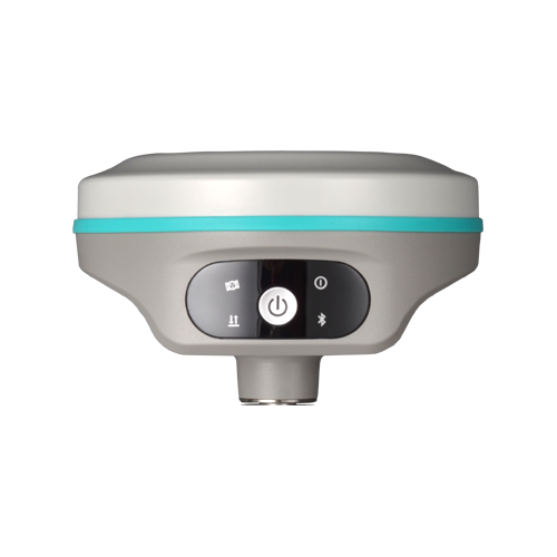
| New Design for New ROVA3 With the high-gain GNSS antenna of our latest design in 2025, the usability of Glonass & Galileo satellites is greatly improved, so even in harsh environment ROVA3 still is able to track more satellite than other receivers and deliver centimeter accuracy positioning result in few seconds. |  |
Galileo HAS and BDS PPP are available! By receiving corrections delivered directly from L-band satellites, ROVA3 allows you to achieve 10 to 20 centimeter-level accuracy with only one rover on hand when base receiver or CORS service is not accessible in remote areas. (this function requries registration code, please apply from your dealers) | 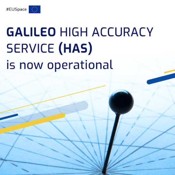 |
RTK Go 2025 Onboard RTK GO app now features Laser measurement and Visual Positioning, Measure & Draw, CAD Draw, CAD Stakeout, Live-View Stakeout, Total Station Module… with a series of new functions. GEO Data Lab has been updated with 3D modelling, RTK-PPK check, long baseline adjust… More New functions. | 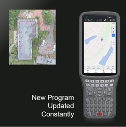 |
Farlink Pro Radio ROVA3 features Farlink Pro radio module and protocol. Which can transmit large quantity of data with very less loss. It is special designed for surveyors who need to work in harsh environment. | 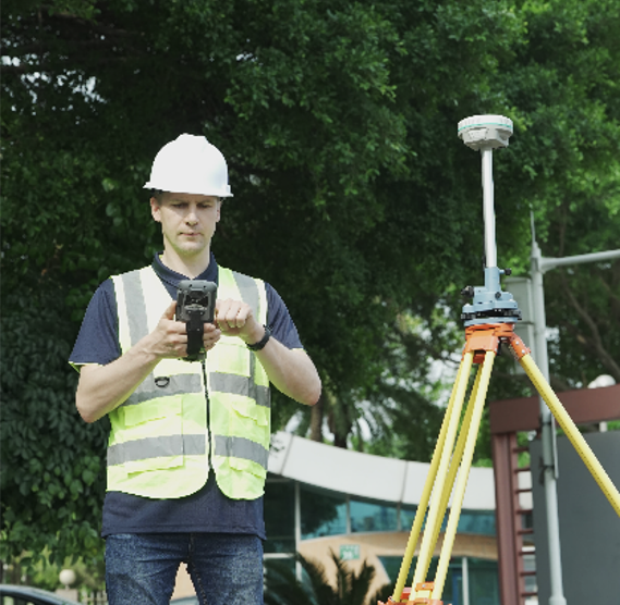 |
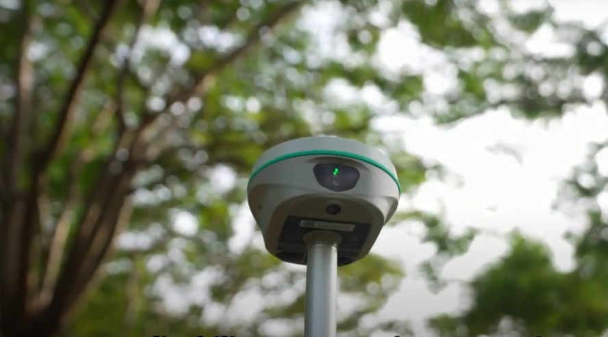
The 5th Gen. IMU ROVA3’s IMU sensor is almost all-time available. When surveyor rotate the pole while walking, or changing the attitude of the receiver, the availability status won’t be easily lost. The IMU is calibrate-free. | 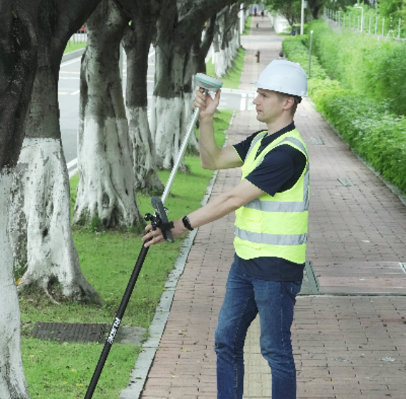 |
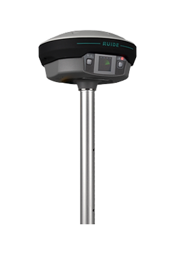
RENO 1
Touch Screen & The Most Powerful Inbuilt Radio
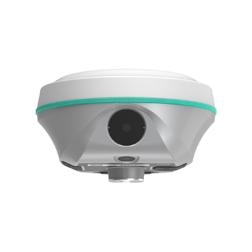
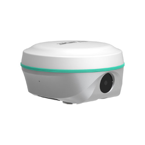
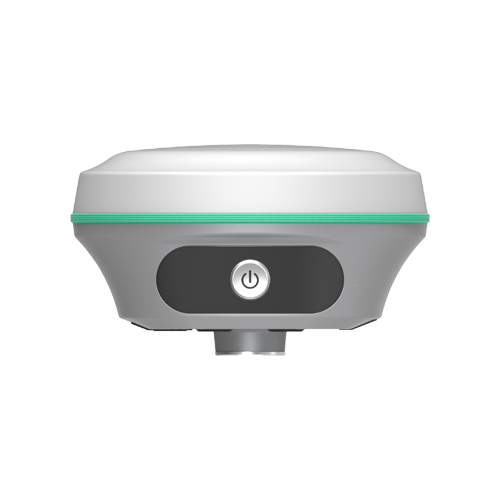
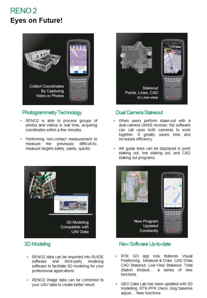
RENO 2
Dual Camera Visual Positioning & 3D Modelling

RENO 2s
Dual Camera Visual Stakeout

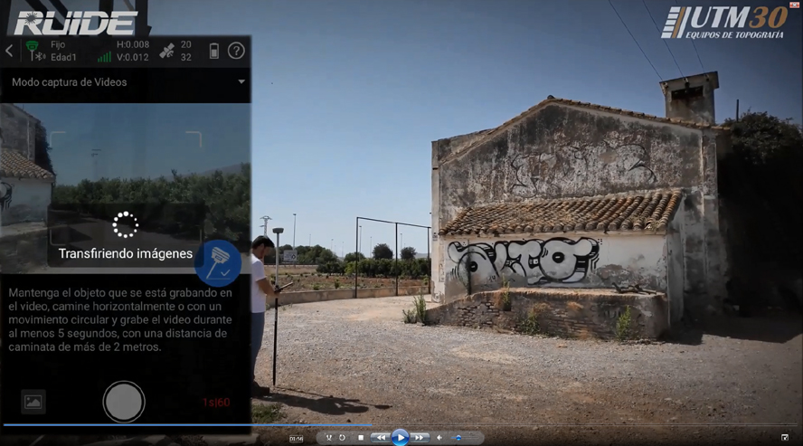
Video: How Dual-Camera Stakeout Works
Video: Where to Perform Visual Positioning (Optional Function)
Video: How 3D Modeling Works (Optional Function)
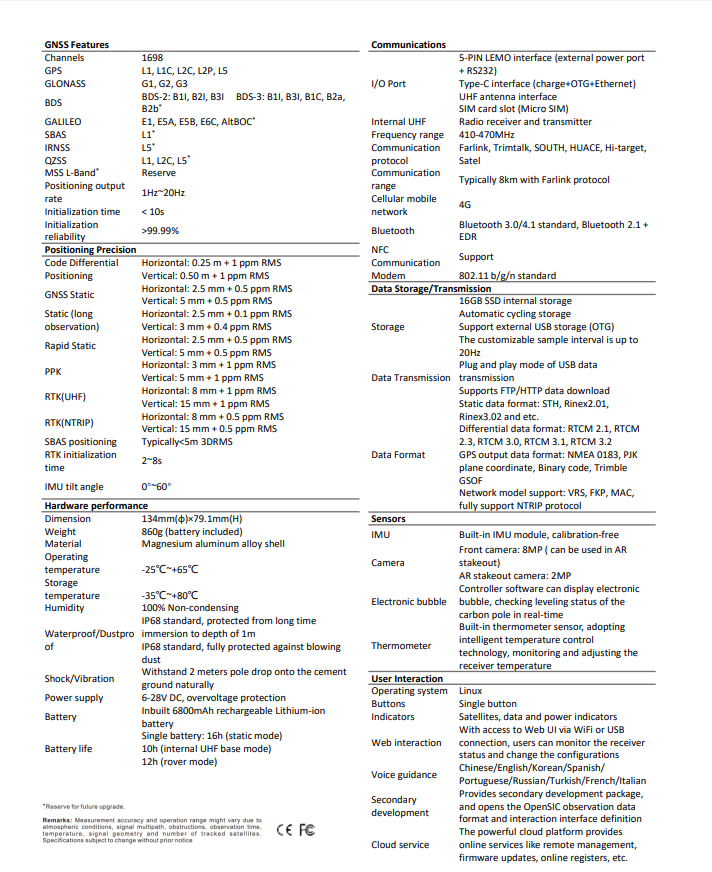
New Generation GNSS Engine S805 Through years of development of multi-satellite positioning algorithms, now we introduce S805 GNSS Engine to you. S805 features 1698 channels, superior GNSS signal capturing capability, better success rate, faster speed of obtaining fixed-solution. | |
Dual Camera Stakeout When users perform stake-out with a dual-camera GNSS receiver, the software can call upon both cameras to work together. It greatly saves time and increases efficiency. AR guide lines can be displayed in point staking out, line staking out, and CAD staking out programs. | 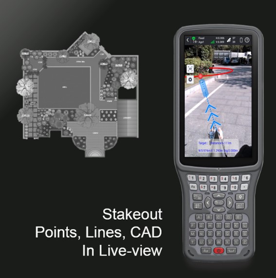 |
New Software Up-to-date RTK GO app now features Visual Positioning, Measure & Draw, CAD Draw, CAD Stakeout, Live-View Stakeout, Total Station Module… with a series of new functions. GEO Data Lab has been updated with 3D modelling, RTK-PPK check, long baseline adjust… More New functions. | |
Farlink 2.0 Radio RENO 2s’ Farlink radio module has been updated to 2.0 version, which can transmit large quantity of data with very less loss. Base-lock function has been added too. | |
The 5th Gen. IMU RENO 2s’ IMU sensor is almost all-time available. When surveyor rotate the pole while walking, or changing the attitude of the receiver, the availability status won’t be easily lost. The IMU is calibrate-free. | |
Galileo HAS and BDS PPP are available! By receiving corrections delivered directly from L-band satellites, RENO2s allows you to achieve 10 to 20 centimeter-level accuracy with only one rover on hand when base receiver or CORS service is not accessible in remote areas. (this function requries registration code, please apply from your dealers) | |
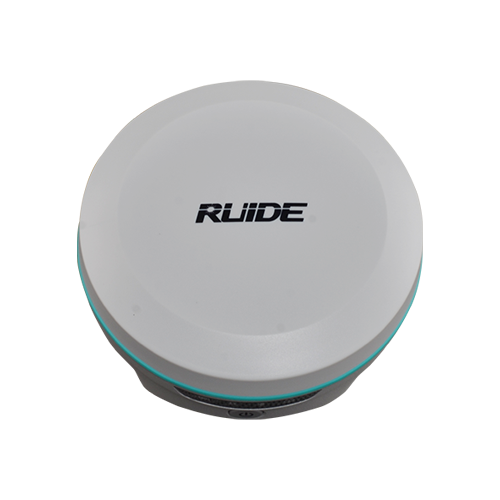
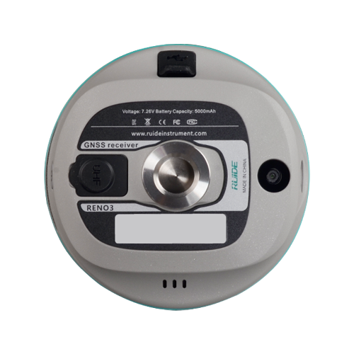
RENO3
Pocket Sized RTK
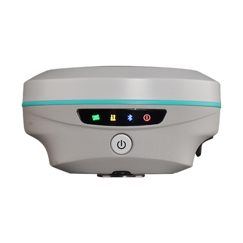
Dual Camera AR StakeoutIntutive and Precise RENO3 allows you to use both of front camera and bottom camera to stakeout points, lines, curves. The AR guideline on controller app will indicate you to go to the correct direction since you are tens of meters away from the target. | |
Visual Positioning (Optional)Eficient,Less-blind spot,Safer. With the optional photogrammetry feature, users can use the RENO3 to perform non-contact measurement, processing a group of photos or a video in realtime, obtaining coordinates for hundreds of points within minutes. | |
The 5th Gen. IMUSimpler and Easier-to-Use RENO3’s IMU sensor is almost all-time available. When surveyor rotate the pole while walking, or changing the attitude of the receiver, the availability status won’t be easily lost. The IMU is calibrate-free. | |
RTK Go 2025 Onboard RTK GO app now features Laser measurement and Visual Positioning, Measure & Draw, CAD Draw, CAD Stakeout, Live-View Stakeout, Total Station Module… with a series of new functions. GEO Data Lab has been updated with 3D modelling, RTK-PPK check, long baseline adjust… More New functions. | |
Product Videos https://www.youtube.com/watch?v=G3UCMWjenEI | |
RAMA1
2025 New Model

RAMA1
Designed to Break Cliches
A blend of imagination, ability and flexibility
Video: How to Perform Laser Measurement
Video: How Dual-Camera Stakeout Works
RAMA1 is Designed, styled and engineered with a blend of bold imagination, extraordinary work ability and amazing flexibility.
There are so many no-compromise reasons to choose RAMA1, from the intelligent design of software, long-range measurement capability, diverse surveying mode offering, to the overall quality, durability, and the industry-leading reliability of the brand and its distributor lineup.
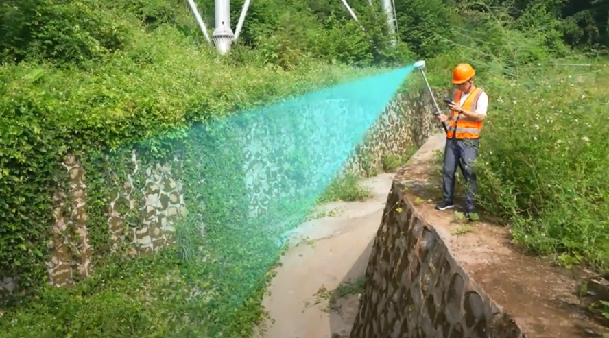
The all-new laser measurement way is 20% even more efficient than you’d get from a traditional GNSS RTK. And it kicks in the instant you press the button on controller app, to measure the target that you were difficult to reach before. Until you experience it, you won’t know what the future holds.
Let’s Experience the new way of Stakeout is A new 8MP front camera and 2MP bottom camera combining with AR technology provide precise direction and dynamic responsiveness. Let your intuition lead you to the right destination.
Video: RAMA1-UNBOXING
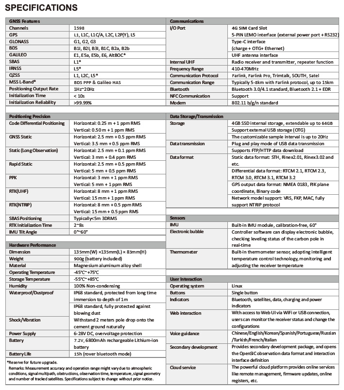
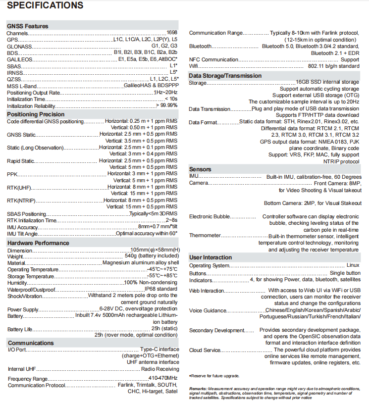
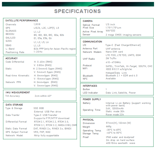
| Satellite Tracking Ability | ||
| Channels1698 channels | ConstellationGPS, GLONASS, BEIDOU, GALILEO, QZSS, SBAS | L-BandBDS PPP & Galileo HAS |
| Positioning Output Rate1-20 HZ | Initialization Time2-8 s | |
| Positioning Precision | ||
| UHF RTKHorizontal ±8mm 1 ppm Vertical ±15mm 1 ppm | Network RTKHorizontal ±8mm 0.5 ppm Vertical ±15mm 0.5 ppm | |
| Static and Fast-Static Horizontal ±2.5mm 0.5 ppm Vertical ±5mm 0.5 ppm | RTK Initial time 2-8s | |
| User Interaction | ||
| Operation SystemLinux | Keypad1 physical button | wifiYes |
| Voice Guideyes, 8 language | Data Storage16 GB internal, 64 GB external | Web UIYes |
| Working Capability | ||
| Laser MeasurementShooting Laser to measure coordinate & stakeout | ||
| Visual Stakeout with ARUses Dual-Camera to stakeout pts, lines, CAD | RadioBuilt-in transmitting and receiving, 1/2 W | Tilt Survey Inertial Measurement |
| Enduranceup to 16 hours (static mode), up to 12 hours (rover mode), up to 10 hours (UHF base mode) | OTG (Field Download)yes | Electronic Bubble Yes |
RAMA2
2025 Flagship Model
RAMA 2
Designed to Break Cliche
A blend of imagination, ability and flexibility
Video: How to Perform Laser Measurement
Video: How to Perform Photogrammetry Measurement
Video: How 3D Modeling Works
(https://www.youtube.com/watch?v=xsjFOBd9IQ4)
Video: How Dual-Camera Stakeout Works
RAMA2 is Designed, styled and engineered with a blend of bold imagination, extraordinary work ability and amazing flexibility.
There are so many no-compromise reasons to choose RAMA2, from the intelligent design of software, long-range measurement capability, diverse surveying mode offering, to the overall quality, durability, and the industry-leading reliability of the brand and its distributor lineup.
The all-new laser measurement way is 20% even more efficient than you’d get from a traditional GNSS RTK. And it kicks in the instant you press the button on controller app, to measure the target that you were difficult to reach before. Until you experience it, you won’t know what the future holds.
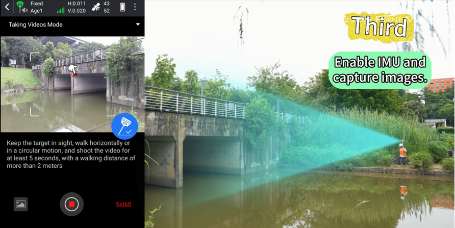
RAMA2’s advanced photogrammetry technology enable users to easily acquiring coordinates for hundreds of points within minutes, by using the 8MP front camera to shoot a video or some photos.
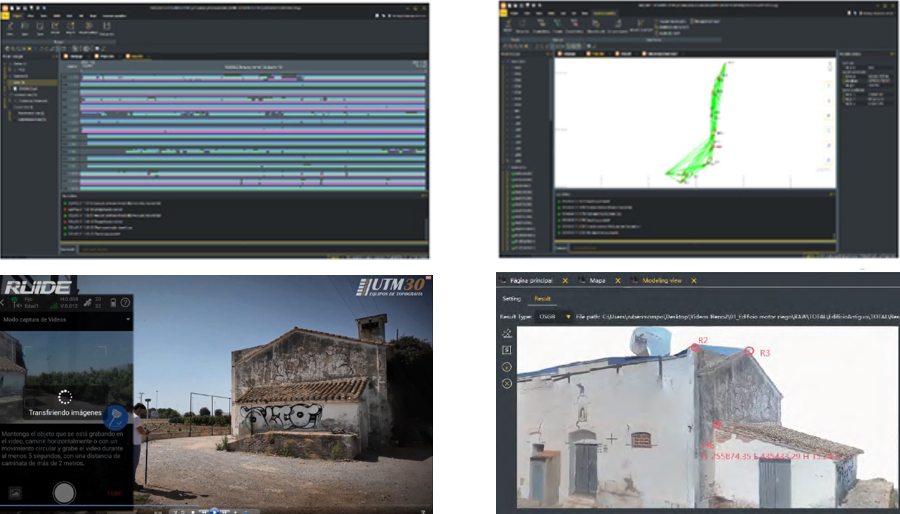
The video and photos captured by RAMA2 also can be used to process out 3D model. The data output can be used with the 3rd party designing software, also can be combined with Drone (UAV) data, such as DJI and other brands.
Let’s Experience the new way of Stakeout is A new 8MP front camera and 2MP bottom camera combining with AR technology provide precise direction and dynamic responsiveness. Let your intuition lead you to the right destination.
| Satellite Tracking Ability | ||
| Channels1698 channels | ConstellationGPS, GLONASS, BEIDOU, GALILEO, QZSS, SBAS | L-BandBDS PPP & Galileo HAS |
| Positioning Output Rate1-20 HZ | Initialization Time2-8 s | |
| Positioning Precision | ||
| UHF RTKHorizontal ±8mm 1 ppm Vertical ±15mm 1 ppm | Network RTKHorizontal ±8mm 0.5 ppm Vertical ±15mm 0.5 ppm | |
| Static and Fast-Static Horizontal ±2.5mm 0.5 ppm Vertical ±5mm 0.5 ppm | RTK Initial time 2-8s | |
| User Interaction | ||
| Operation SystemLinux | Screen DisplayColorful Display | wifiYes |
| Voice Guideyes, 8 language | Data Storage16 GB internal, 64 GB external | Web UIYes |
| Keypad2 physical buttons | ||
| Working Capability | ||
| Laser MeasurementShooting Laser to measure coordinate & stakeout | Visual PositioningShooting photo or video to measure coordinate | 3D ModelingProcess by Post-processing software |
| Visual Stakeout with ARUses Dual-Camera to stakeout pts, lines, CAD | RadioBuilt-in transmitting and receiving, 1/2 W | Tilt Survey Inertial Measurement |
| Enduranceup to 16 hours (static mode), up to 12 hours (rover mode), up to 10 hours (UHF base mode) | OTG (Field Download)yes | Electronic Bubble Yes |
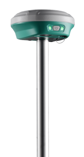
V1
AR GNSS Receiver
 |
RADIO TX / RX 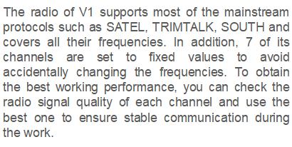 INERTIAL MEASUREMENT UNIT 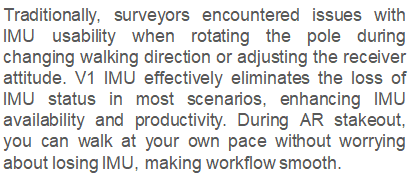 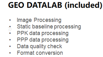  |
Let’s Connect
Need assistance? Get in touch with our team.