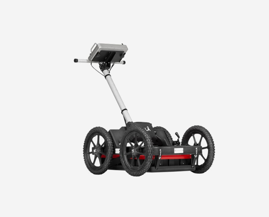
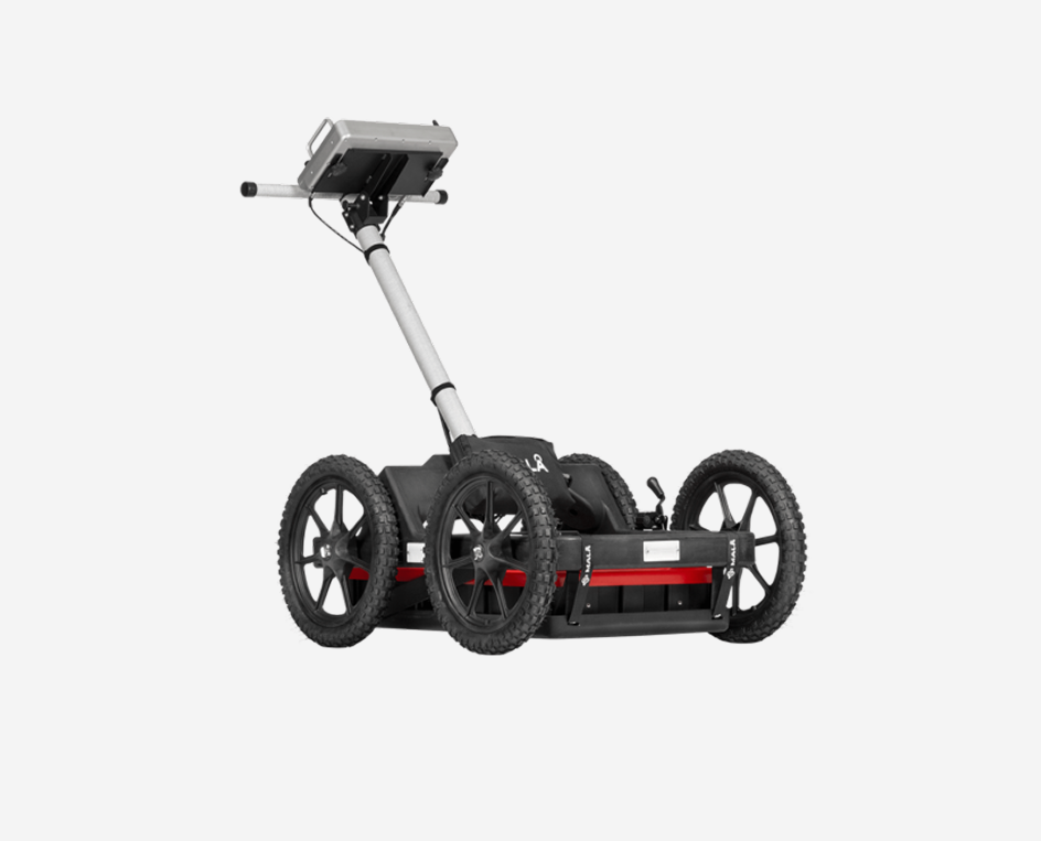
MALÅ Easy Locator
MALÅ Easy Locator Core
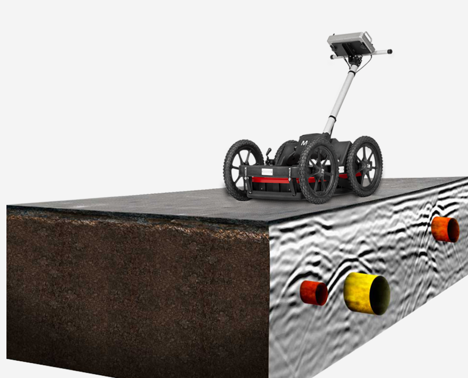
The world’s first intelligent Ground penetrating radar (GPR) solution
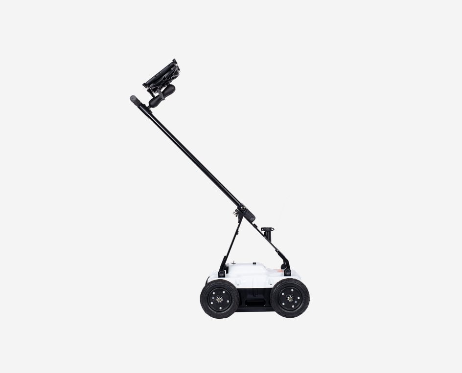
MALÅ Easy Locator Core is the state of the art, intelligent ground penetrating radar solution for utility locating professionals.
MALÅ Easy Locator Core includes the best data quality on the market, real-time interpretation support through MALÅ AI; wireless data collection using mobile devices; cloud storage, post-processing and on-site reporting using MALÅ Vision.
All with the fastest workflow on the market.
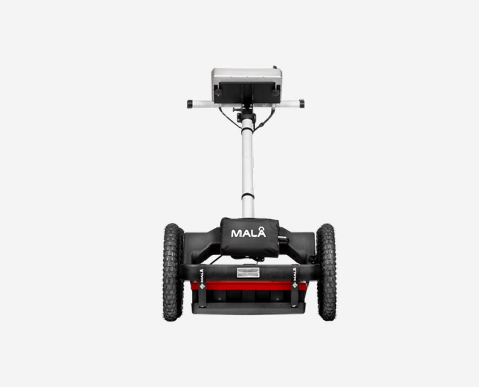
The new industry standard for utility locating


Intuitive for beginners – Complete for experts
The first Easy Locator series became the industry standard two decades ago. The Easy Locator Core is now the new standard for utility locating professionals.
Easy Locator Core is the result of Guideline Geo’s commitment to deliver customer-oriented solutions. The Easy Locator Core is a state-of-the-art Swedish quality product built on the latest research and innovation.
- Optimized for locating and mapping utilities
- Swedish quality, unparalleled performance and a variety of revolutionary new features
- Lighter and easier to use than anything else
- Rugged and capable of traversing the toughest terrain
- Unsurpassed resolution, bandwidth, and data clarity
- Real-time interpretation from MALÅ AI while collecting data
- Access and share your data anywhere on any device
- Cloud-connected to MALÅ Vision for instant processing in the field
- Constantly updated with new unique features and improvements
- Built with the pride and the passion of a company with a century as leaders in geophysics
- All with the fastest workflow on the market
Optimized for locating and mapping utilities
Lighter and easier to use than anything else
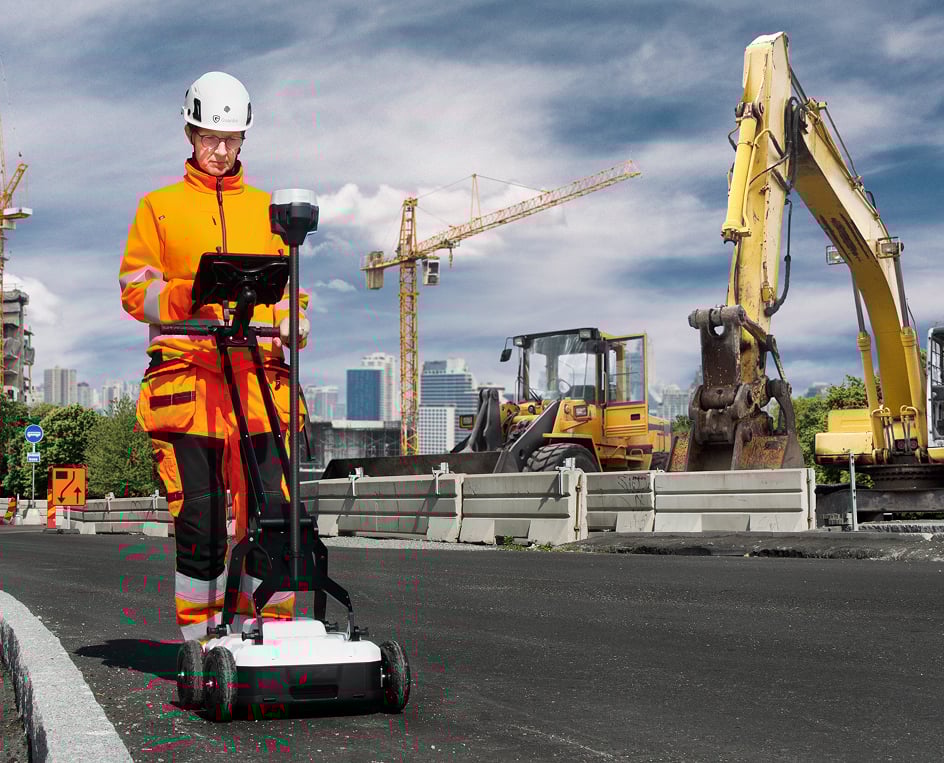
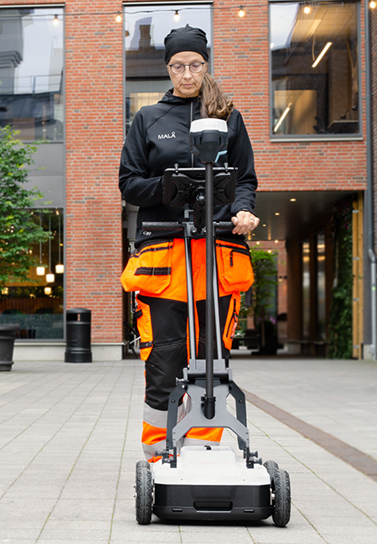
The Locating industry demands high quality, ruggedized and precise GPR equipment. Field equipment needs to be easy to transport, quick to setup and use and with the right functionality to efficiently getting the job done.
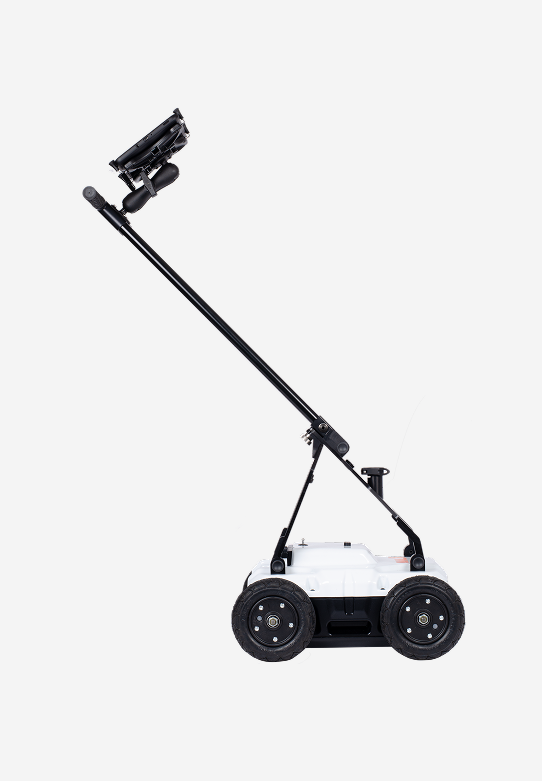
The MALÅ Easy Locator Core is the new market leader in GPR utility locating and mapping. Its functional design and ease of use are desired by utility locators world-wide.
It’s lighter and easier to use than anything else but also extremely rugged and capable of traversing the toughest terrain when combined with the recommended RTC Mini option.
MALÅ AI
Real time MALÅ AI interpretation support
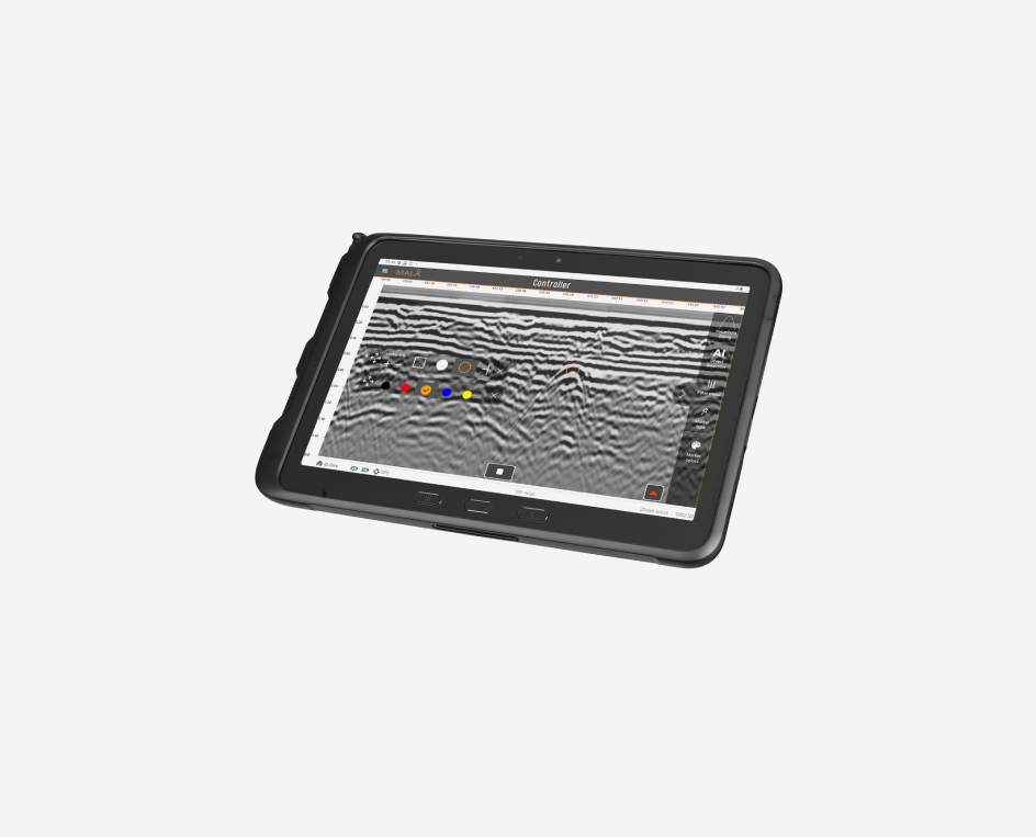
Real-time MALÅ AI interpretation support is a revolution in the GPR world. MALÅ Easy Locator Core is the first product world-wide using intelligent real-time interpretation support for utility locating. All markers set by MALÅ AI can be converted to standard markers with localized utility color codes directly in the field. This provides an invaluable interpretation support for inexperienced users, but also speeds up the interpretation process for more experienced users, thus saving valuable time. When point objects have been identified and marked with the real-time MALÅ AI interpretation support tool the markers can be converted into regular object markers and exported to MALÅ Vision for further processing.
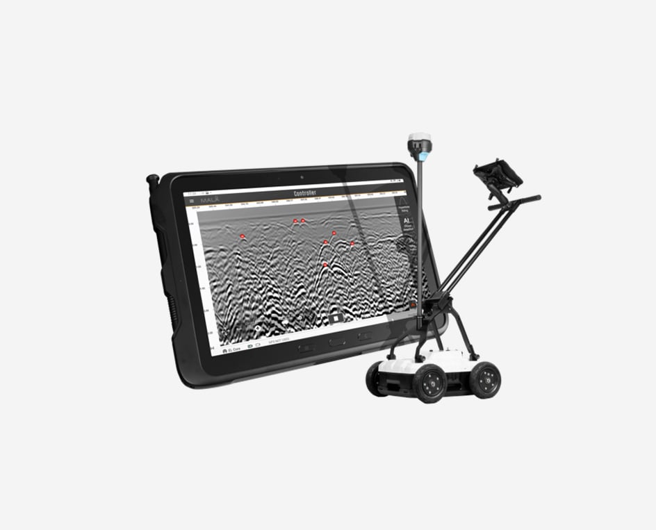
MALÅ Controller App
Acquisition software for the Easy Locator Core
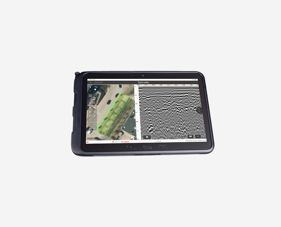
MALÅ Controller App is an easy-to-use acquisition software optimized for Utility Locating with the Easy Locator Core. It also supports other App-Enabled products from MALÅ. It helps you to go as fast as possible from data collection to delivering results. The intuitive user interface lets you view and interpret while data is being collected. All with real-time interpretation support from MALÅ AI. Set gain and contrast, remove background noise and set object and surface markers. The touch-based interface speeds up your survey, letting you deliver results quicker.
MALÅ Vision
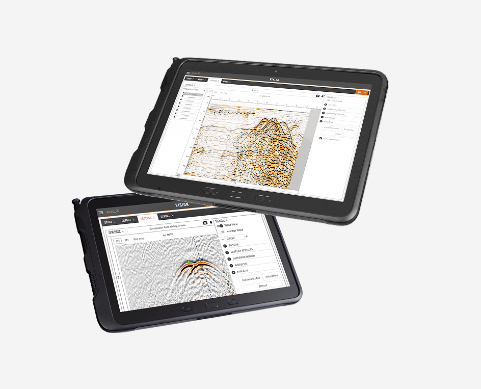
Processing software for the Easy Locator Core
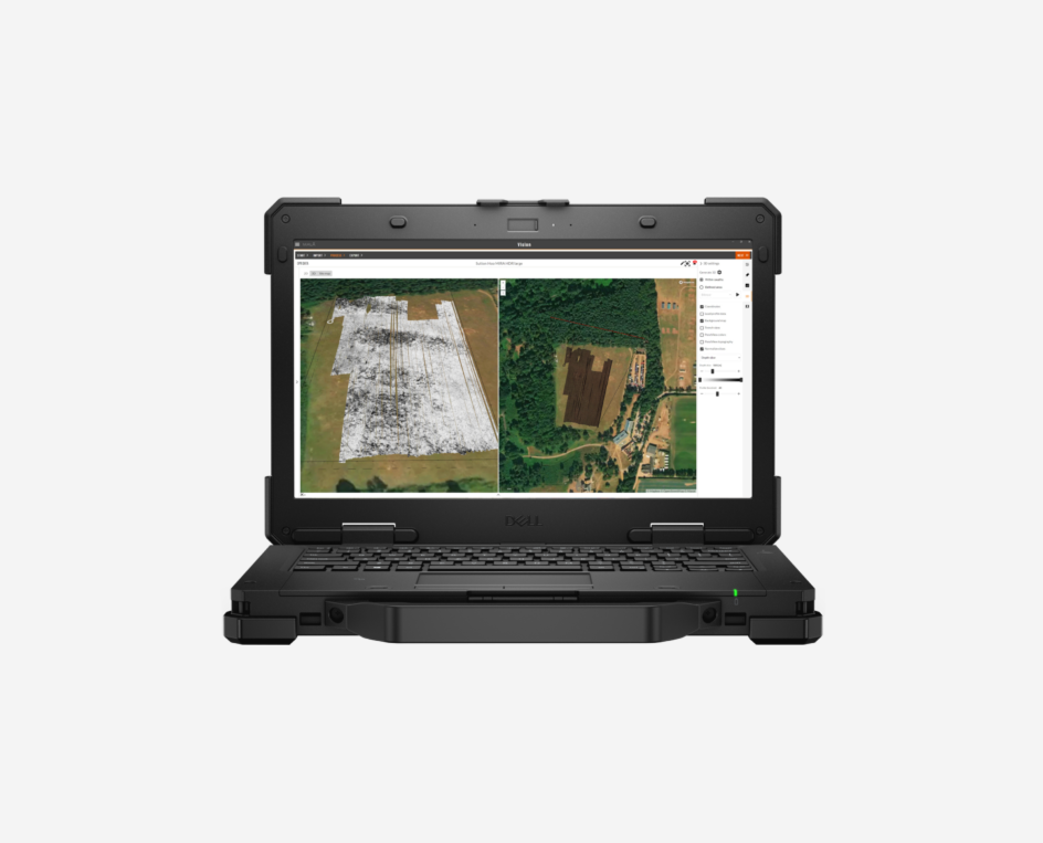
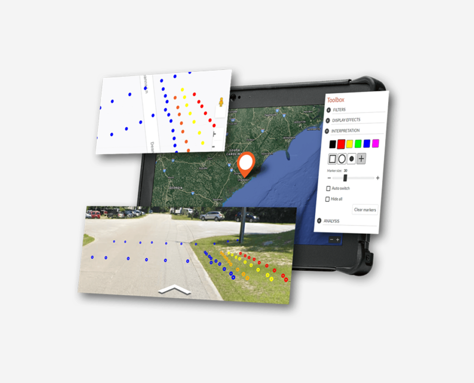
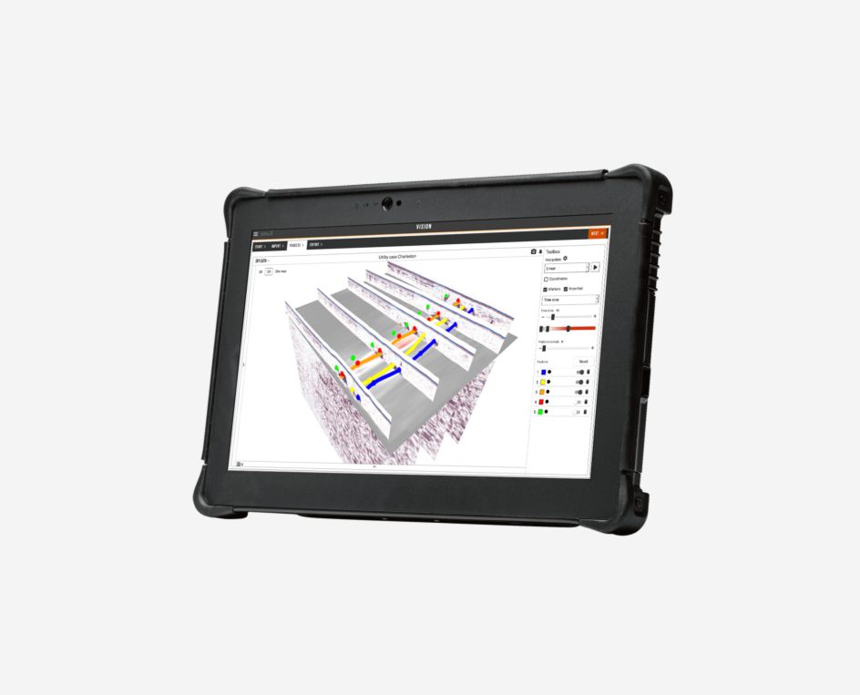
MALÅ Vision is a user-friendly GPR processing software designed to handle GPR data on any device, catering to all types of GPR users. It features MALÅ AI, which offers automated interpretation support and advanced functionalities like automated polylines. This cloud-based post-processing software utilizes MALÅ AI to analyze markers, identifying potential locations of pipes and cables in your data set. Document all buried assets and visualize your results on Google Maps or OpenLayers. You can also use satellite images or Street View for a first-person perspective of your site. Easily share your findings by exporting them as printed maps, DXF, or KMZ files.
MALÅ Easy Locator WideRange
Locate buried metallic and non-metallic utilities

The MALÅ Easy Locator series is the standard within utility locating using GPR. Providing the best data quality on the market, ease-of-use and unsurpassed precision.
MALÅ Easy Locator revolutionized the utility market with a completely new approach. With its rugged design, ease of use, best data quality and outstanding precision, it is the standard within the locating industry. The dual antenna WideRange option is suitable for both shallow high-resolution surveys and deeper investigations.
The next step in GPR system evolution

MALÅ HDR real-time technology delivers ultra-fast data acquisition.
MALÅ HDR technology is faster, offers the best data resolution, and has significantly better penetration depth than competitive products.
Due to the real-time sampling technology, antenna design and pulse generator, HDR offers much broader bandwidth, producing both higher resolution and better depth penetration at comparable centre frequencies. The HDR technology is ultra-fast and will stack each data point up to thousand times, drastically improving signal to noise ratio. The MALÅ Easy Locator series is the gold standard for GPR data quality.
Designed for utility locating and mapping
Built on experience – Designed for its application
The Locating industry demands high quality, ruggedized and precise GPR equipment. Field equipment needs to be easy to transport, quick to setup and use, and with necessary functionality to efficiently getting the job done. The MALÅ Easy Locator is the market leader in GPR utility locating and mapping. Its functional design and ease of use is appreciated by utility locators world-wide.
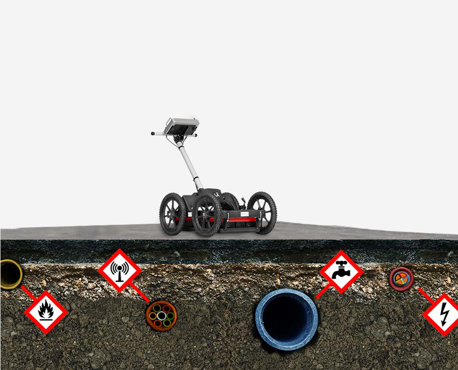
Precise positioning
Precise positioning is key for effective buried assets management
Buried utilities are assets that needs proper geo-referencing. Both planar coordinates and depth are needed to protect these assets from costly mistakes and accidents. MALÅ Easy Locator WideRange has built-in DGPS (SBAS) and supports all major brands of stand-alone, high-precision, GPS solutions. Guideline Geo also provides Emlid RTK GPS for sub-centimetre accuracy if needed.
Analyze and process data on your mobile device
Visualize and present GPR data in 2D and 3D
MALÅ Easy Locator WideRange data is easily imported directly into MALÅ Vision. MALÅ Vision is the easiest to use software in the industry. It is the fastest way to go from data collection to delivering a report.
Import, process, interpret and report your data directly in the field using a mobile device. MALÅ Vision provides a very efficient work-flow and is cutting work hours down to a minimum.
Rough Terrain Cart
For all GPR surveys conducted on rough surfaces
The MALÅ Easy Locator WideRange antenna and monitor can be mounted in the MALÅ Rough Terrain Cart (RTC), increasing the operational capabilities in more rugged terrain. The cart is available in two sizes, to accommodate the choice of antenna.
Let’s Connect
Need assistance? Get in touch with our team.